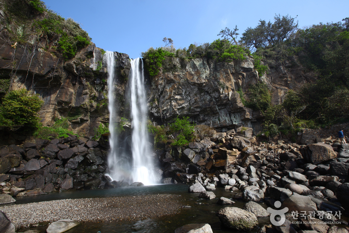
Jeongbangpokpo Falls (정방폭포)
2024-10-08
37 Chilsimni-ro 214beon-gil, Seogwipo-si, Jeju-do
Jeongbangpokpo Falls, one of the three major waterfalls in Jeju-do, along with Cheonjiyeonpokpo Falls and Cheonjeyeonpokpo Falls, is located about 1.5 kilometers southeast of the center of Seogwipo.
The waterfall is the only coastal waterfall in Asia that falls directly into the sea, reaching 23 meters in x_height, 8 meters in x_width, and 5 meters in depth. When sunlight is reflected on the pouring water with the magnificent sound of a waterfall, a rainbow of seven colors harmonizes with the blue sea, creating a captivating atmosphere. On the high cliffs along the beach, old pine trees stand with branches hanging over the sea as if they were falling.
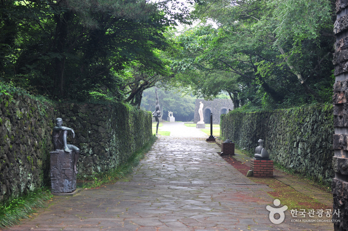
Jeju Art Park (Forest Fantasia) (제주조각공원(포레스트 판타지아))
2021-01-25
1836, Iljuseo-ro, Seogwipo-si, Jeju-do
+82-64-794-9680
Jeju Art Park opened in October 1987 in a large primeval forest. The park features around 160 sculptures made by 109 famous Korean artists in the theme of "Meeting of Nature, Art, and People." Each of the sculptures is set to harmonize with the beautiful natural surroundings. The park also features various facilities to enjoy, such as art events, an exhibition hall, and an observation deck with views of Hallasan Mountain and Marado Island, the southernmost land of Korea.
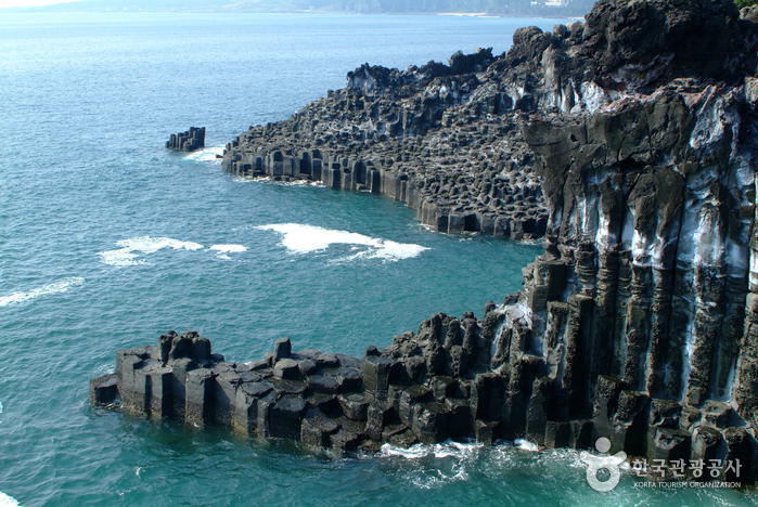
Daepo Jusangjeolli Cliff (주상절리대(대포동지삿개))
2024-03-11
36-30, Ieodo-ro, Seogwipo-si, Jeju-do
Daepo Jusangjeolli Cliff is a stone pillar formed by lava that flowed out of the crater and contracted as it cooled rapidly. It is characterized by its polygonal staircase-like form. The stones are 30 to 40 meters high, hexagonal in shape, and line the coast for about 1 kilometer. The constant crashing of the waves is a highlight not to be missed.
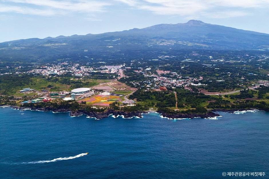
Jungmun Tourist Complex (중문관광단지)
2026-01-29
38 Jungmungwangwang-ro, Seogwipo-si, Jeju-do
Jungmun Tourist Complex is a comprehensive resort area spanning across Jungmun-dong, Saekdal-dong, and Daepo-dong in Seogwipo-si. It features luxury accommodations such as The Suites Hotel and Lotte Hotel Jeju, along with various tourist, convention, shopping, and cultural facilities. Additionally, there are leisure facilities like the Yeomiji Botanic Garden, PLAY K-POP, and Pacific Land. The unique natural environment of Jeju, including Jungmun Saekdalhaebyeon Beach, offers opportunities for marine sports such as surfing, yachting, and parasailing, providing enjoyment amidst Jeju's distinctive coastal settings.
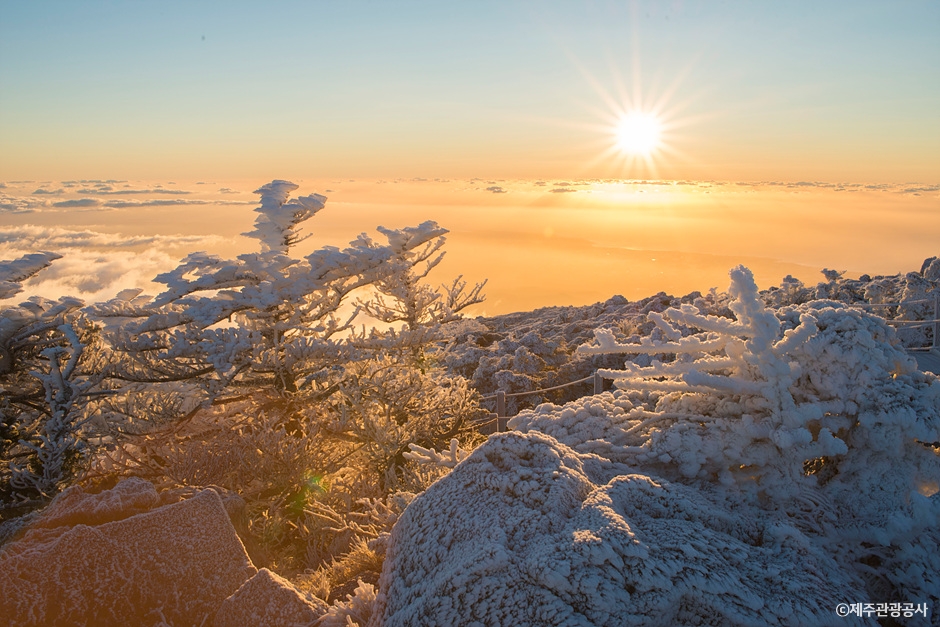
Hallasan Mountain (한라산)
2025-10-31
San 15-1 Topyeong-dong, Seogwipo-si, Jeju-do
Hallasan Mountain stands proudly at the center of Jeju Island and is perhaps the island’s most memorable landmark. Also called Yeongjusan Mountain, meaning "mountain high enough to pull the galaxy," Hallasan Mountain is widely known by scientists for its geological value. Designated as a national park in 1970, there are 368 parasitic cones called "oreum" (Jeju dialect meaning peak) around the main mountain.
Hallasan Mountain is famous for its vertical ecosystem of plants that results from the varying temperatures along the mountainside. Over 1,800 kinds of plants and 4,000 species of animals (3,300 species of insects) have been identified; to explore the mountain's treasures, simply follow one of the well-developed hiking trails.
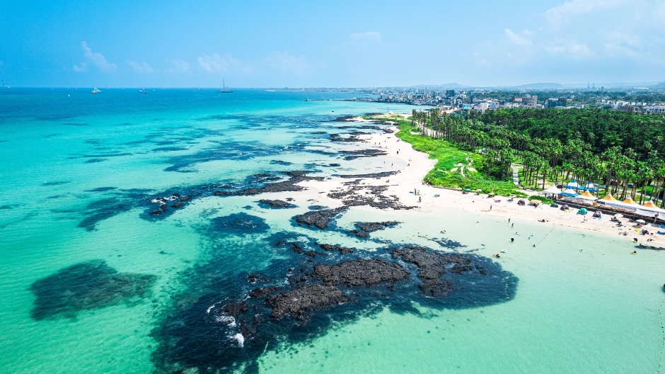
Hyeopjae Beach (협재해수욕장)
2026-05-27
329-10 Hallim-ro, Hallim-eup, Jeju-si, Jeju-do
Hyeopjae Beach, encircled by lush pine forests, seamlessly extends into Geumneung Beach. The beach features smooth white sand, shallow waters, and a gentle slope ideal for swimming. Camping is available at Songlim, along with various amenities. The view of the emerald-colored sea and the distant Biyangdo Island offers magnificent scenery, with the sunsets being particularly breathtaking. ◎ Travel information discovering the charm of Hallyu The refreshing sound of waves, the emerald-colored sea, and SEVENTEEN warmly waving from black basalt rocks beside the white sandy beach create a picturesque scene. In , a song dedicated to their fans, CARAT, SEVENTEEN delivers a heartfelt message about beautiful love. Hyeopjae Beach is known for its shallow waters, making it ideal even for visitors who cannot swim. Surrounded by palm trees, pine forests, and grassy fields, it is also a great place for walking and camping.
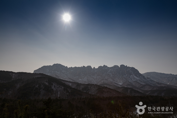
Seoraksan Ulsanbawi Rock (설악산 울산바위)
2024-02-28
1091 Seoraksan-ro, Sokcho-si, Gangwon-do
Ulsanbawi is a rock formation in Seoraksan Mountain that consists of six massive peaks, each reaching 900 meters above sea level. The name "Ulsanbawi" is derived from the shape of the peaks, which spread out like a fence, and it is located at the center of Seoraksan Mountain. This rock is celebrated for its unique shape, the scenic beauty surrounding it, and its hiking trails. It takes about three hours to reach the top of Ulsanbawi from Sogongwon Park.

Udo Island (Udo Maritime Park) [우도(해양도립공원)]
2025-03-31
1 Samyanggosumul-gil, Udo-myeon, Jeju-si, Jeju-do
Udo Island is celebrated for its stunning natural beauty, characterized by its unique status as a single volcanic structure. It is renowned for its eight scenic views, offering tourists a variety of attractions including the expansive coral sand beach and clear waters of Hagosudong Beach. Activities available for visitors include fishing, bicycle hiking, submarine rides and cruises. It is conveniently accessible, with a short ferry ride of about 15 minutes from Seongsan or Jongdal Ports.
Jungmun Saekdalhaebyeon Beach (중문·색달해변)
2024-02-22
29-51 Jungmungwangwang-ro 72beon-gil, Seogwipo-si, Jeju-do
Jungmun Saekdalhaebyeon Beach is a white sandy beach with a bow-like shape. The uniquely colored beach blends beautifully with the volcanic rocks. It is known as an attraction for surfers due to its frequent winds and large, high waves, and it hosts international surfing competitions.
Cheonjeyeonpokpo Falls (천제연폭포)
2024-11-28
132 Cheonjeyeon-ro, Seogwipo-si, Jeju-do
Cheonjeyeonpokpo Falls is named Cheonjeyeon (The Pond of God) because seven nymphs are said to descend from the cloud bridge in the middle of the night, play on the ground for a while, and then ascend back to the sky. The three-tiered waterfall cascading through the dense forest is a breathtaking sight. The water forms a pond off the first waterfall, which flows into the sea via the second and third waterfalls. Visitors can also admire the Seonimgyo Bridge with seven nymphs carved on the side.
 English
 한국어
한국어 日本語
日本語 中文(简体)
 Deutsch
 Français
 Español
 Русский


