Jangheung Jeongnamjin (정남진(장흥))
2026-06-30
Gwansan-eup, Jangheung-gun, Jeonnam-Gwangju Special Metropolitan City
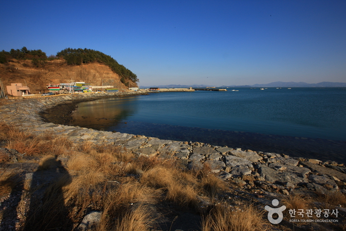
Jangheung-gun’s Jeongnamjin is the warmest place on the Korean mainland. The region has a diverse natural environment including stunning views of mountains, fields, the ocean, lakes, rivers and streams. It also has several cultural and tourist sites such as Cheongwansan Mountain, Bangchon Cultural Village, and Borimsa Temple, one of the three Borimsa Temples in Asia.
The Jeongnamjin district has a wide variety of tourist attractions nearby such as the Samsan Embankment; a provincial park on Cheongwansan Mountain; a literature park; and Sodeungseom Island, a famous sunset attraction often used as a filming location and festival grounds. A number of festivals are held around the area to promote the region's diverse produce and beauty.
Saemangeum (새만금)
2026-06-10
6 Saemangeum-ro, Byeonsan-myeon, Buan-gun, Jeonbuk-do
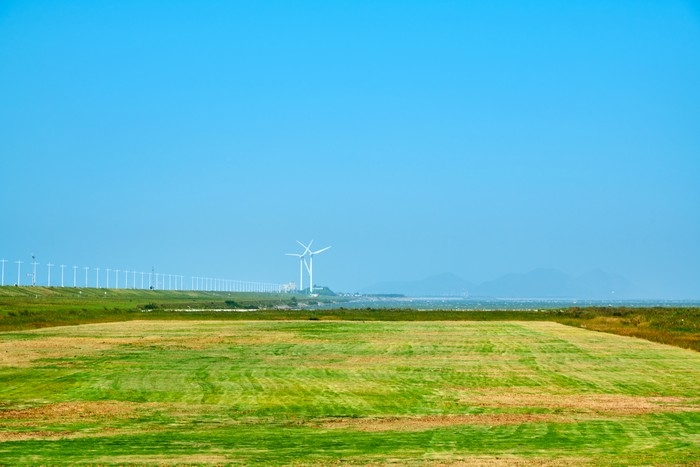
Saemangeum is an area created by the reclamation project to build a sea wall connecting Gunsan and Buan. After 20 years of construction, the Saemangeum Seawall was completed in 2010. Stunning sunsets can be seen from the dike, and various facilities such as campgrounds and the Saemangeum Project Office are well prepared for visitors experience. It is also known as a filming location for BTS's music videos.

Cheongnyeongpo Meandering Stream (영월 청령포)
2026-04-14
Gwangcheon-ri, Nam-myeon, Yeongwol-gun, Gangwon-do
Cheongnyeongpo Meandering Stream, located in the upper reaches of the Namhangang River in Gwangcheon-ri, Nam-myeon, Yeongwol-gun, is the place where King Danjong stayed after being dethroned and exiled to Yeongwol. Danjong, the 6th king of the Joseon dynasty, abdicated the throne to his uncle, who became King Sejo. However, in 1456, the following year, there was a movement by six court officials to restore King Danjong to the throne, resulting in his demotion and exile to Cheongnyeongpo area. Cheongnyeongpo was surrounded by water on three sides—east, south, and north—and a rugged cliff known as Yukyukbong Peak rose to the west, making it impossible to enter or leave without using a boat. King Danjong lived a life of exile cut off from the outside world in this secluded place; it is said that at the time, there was a house available for him to stay in, and the local official, Eom Heung-do, would secretly visit at night to pay his respects. (Information courtesy of Yeongwol Cultural Tourism)
Chuam Chotdaebawi Rock (추암 촛대바위)
2022-12-26
Donghae-si, Gangwon-do
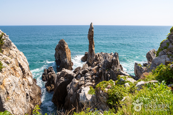
Chuam Chotdaebawi Rock in Donghae-si, Gangwon-do is one of Korea’s most famous tourist attractions. The beautifully formed rock towers high into the sky and resembles a candlestick, from which it gets its name. Chotdaebawi Rock and the nearby rock formations seem to change the shape they resemble along with the waves that crash against the rocks. The view of the sunrise from behind Chotdaebawi Rock is so popular that it attracts photographers and tourists nationwide.
* The Legend of Chotdaebawi Rock
Once upon a time, there was a man who lived in Chuam who had a concubine. His wife was jealous of the second wife and the conflict between the two women continually escalated. One day, god became enraged over their continual quarreling and threw lighting down from heaven, striking both women dead. The newly-made widower missed his wives so much that he remained frozen in his loneliness and eventually turned into a rock, which is now called Chotdaebawi Rock.
![Korean Peninsula Terrain [National Geopark] (한반도지형 (강원고생대 국가지질공원))](http://tong.visitkorea.or.kr/cms/resource/57/2517657_image2_1.jpg)
Korean Peninsula Terrain [National Geopark] (한반도지형 (강원고생대 국가지질공원))
2024-04-08
555 Hanbando-ro, Hanbando-myeon, Yeongwol-gun, Gangwon-do
Korean Peninsula Terrain was formed by soil transported from upstream to the curvature of the confluence of two rivers. It is often referred to as Mini Korean Peninsula because it resembles the shape of the Korean Peninsula. It is said to have this appearance due to the erosion of the incised stream flowing around the terrain. It takes a 15-minute walk along the pine forest trail for about 800 meters from the parking lot to reach there. The well-maintained trail with many wildflowers and plants creates a welcoming atmosphere. Upon arriving at the observation point, visitors will be amazed by the beautiful curved river and the topography taking the same shape as the Korean Peninsula. Designated as the Gangwon Paleozoic National Geopar, this area has excellent geographical value because it shows the characteristics of the incised mender river as well.

Odosan Healing Forest (오도산 치유의 숲)
2026-05-14
398, Odosanhyuyang-ro, Bongsan-myeon, Hapcheon-gun, Gyeongsangnam-do
Odosan Healing Forest is nestled at the foot of the tall Odosan Mountain (1,133 meters above sea level) in Hapcheon. The mountain spans the areas covering Gajo-myeon in Geochang-gun, Gyeongsangnam-do and Myosan-myeon and Bongsan-myeon in Hapcheon-gun, Gyeongsangnam-do. Odosan is at the end of the Gayasan Mountain Range along with Dumusan Mountain (1,039 meters above sea level), which is situated 2 kilometers to the northeast. North of Odosan Healing Forest, you will find Haeinsa Temple, home to the Tripitaka Koreana and one of the three major temples in Korea, as well as Gayasan Mountain, and Maehwasan Mountain. Hapcheonho Lake is south of the forest, so there are several tourist destinations in the area and the natural landscape is superb. The azaleas and royal azaleas are in full bloom in spring; cool valley waters can be enjoyed in summer; and the mountain's colorful fall foliage is as beautiful as that of Naejangsan Mountain, a renowned spot to enjoy autumn colors. You can enjoy mountain climbing along the valley surrounded by thick forests. It is said that Doseon, a well-known monk from the late Silla Dynasty, was fascinated by the energy and beauty of Odosan Mountain and practiced asceticism there.Enjoying the Odosan Recreational Forest Convenient facilities unfold along the valley within the Odosan Recreational Forest, such as the visitor information center, forest cabins, a communal kitchen, camp decks, campsites, etc. Notably, the hiking trail behind the forest cabins follows the clear stream that flows year-round, leading to Sukseongsan Peak, a small peak on the slope of Odosan Mountain. The trail overlooks Hapcheonho Lake and offers hikers a beautiful view. Odosan Recreational Forest consists of dense natural forests filled with pine and oak trees that are 20 to 50 years old. Also, a variety of vegetation, including the wild cherry, crimson glory vine (called meoru in Korea), and kiwiberry vine (called darae in Korea), as well as herbaceous plants can be found here. This makes it an ideal site for students, including teenagers, to learn about nature.
Jirisan Chilseongyegok Valley (칠선계곡(지리산))
2022-07-29
Chuseong-ri, Hamnyang-gun, Gyeongsangnam-do
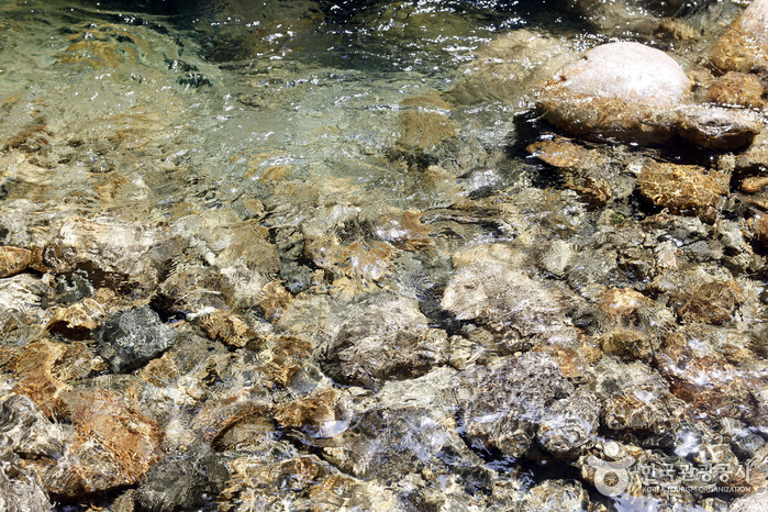
Chilseongyegok Valley is the most beautiful valley in Jirisan Mountain, and is one of the top three valleys in the nation, along with Cheonbuldonggyegok Valley in Seoraksan Mountain and Tamnagyegok Valley in Hallasan Mountain. The 16-kilometer valley stretching from Uitan of Macheon-myeon to Cheonwangbong Peak is characterized by very tough topography but beautiful scenery and is the only remaining primeval forest of Jirisan Mountain. It is also dotted with seven waterfalls and 33 ponds. The hike becomes more difficult as the trail enters the valley. Because the valley has taken many lives, some people call it "The Valley of Death." For that reason, visitors must apply in advance and hike with a guide. The trail in Chilseon Valley is a 9.4-kilometer course from Chuseong Village in Macheon-myeon to Cheonwangbong Peak, which does not follow the natural valley, due to the valley's steep and dangerous features. Starting from Chuseong Village, the trail passes Yongso Pond, Jujiteo Site, Chuseongmang Rock, Seonnyeotang Pond, Ongnyeotang Pond, Biseondam, Chilseonpokpo Falls, Daeryukpokpo Falls, Samcheungpokpo Falls and Mapokpo Falls, all before reaching Cheonwangbong Peak.

Orijangnim Forest in Jacheon-ri, Yeongcheon (영천 자천리 오리장림)
2021-06-11
1421-1, Jacheon-ri, Yeongcheon-si, Gyeongsangbuk-do
Orijangnim Forest is approximately 2 kilometers long, the same length as the Korean measurement of five ri (O-ri). It is also called Jacheon Forest due to its location near Jacheon-ri. The forest was split into two parts after a national roadway was built through the forest. Later, much of the forest was lost due to additional building construction, road expansion, and typhoon. Only some areas in front of Jacheon Village retain the old ambience.
Orijangnim Forest was established to block the strong winds from entering the village, as well as provide bank protection and flood prevention. It is comprised of 280 trees from 12 different species including oriental oaks.
Andong School of Korean Etiquette (안동예절학교)
2023-04-07
1333-5, Toegye-ro, Andong-si, Gyeongsangbuk-do
Andong School of Korean Etiquette, which is located in Andong, is a mecca of Korea's Confucian customs and provides an opportunity to experience traditional Korean etiquette.
In addition to Korean traditional etiquette, Andong School of Korean Etiquette also teaches tea etiquette and traditional Korean music using instruments such as janggu and gayageum. Students can also experience the joy of learning how to play folk games such as yunnori and kite-flying. The school offers a wide variety of hands-on programs related to Korea's traditions and customs such as mask dance, paper craft, cooking, wedding, and eco-rafting on Nakdonggang River.
There are other popular tourist attractions nearby such as Dosanseowon Confucian Academy, Forest Science Museum and Yi Yuk-sa Literary Hall.
Sancheong Hwangmaesan Mountain (황매산(산청))
2021-04-13
Hwangmaesan-ro 1202beon-gil, Sancheong-gun, Gyeongsangnam-do
+82-55-970-6901
One of the last mountains of the Taebaek Mountain Range, Hwangmaesan Mountain is located in Sancheong, Gyeongsangnam-do. The mountain features fantastic rock formations and a beautiful vista from the summit that resembles arpricot blossoms. It is said that anyone who prays from the summit will have their wish come true, drawing in plenty of earnest hikers. In May, a large field near the summit is covered in vibrant pink royal azaleas. Attractions on the mountain include Bakjwigol Valley, Norubawi, Heundeulbawi, Janggunbawi, Chotdaebawi, Geobukbawi and Sinseonbawi Rocks among others.
 English
 한국어
한국어 日本語
日本語 中文(简体)
 Deutsch
 Français
 Español
 Русский


