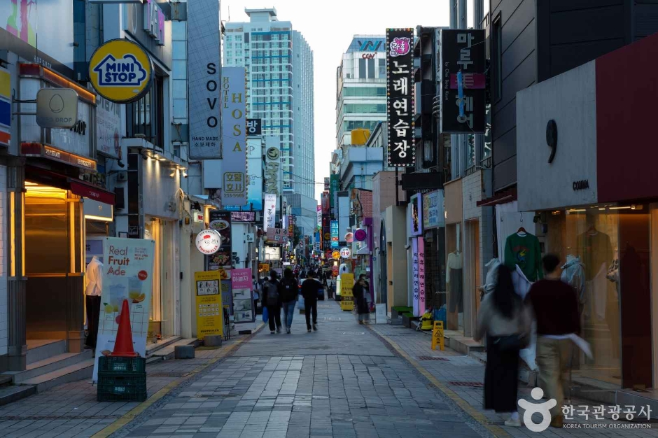
Chungjang-ro Street (충장로)
2026-06-30
37 Seoseok-ro, Dong-gu, Jeonnam-Gwangju Special Metropolitan City
Chungjang-ro Street is Gwangju’s major fashion district, comparable with Myeongdong Street of Seoul. The streets of Chungjang-ro are lined with shopping malls, clothing stores, restaurants, cafes, movie theaters and various other attractions, providing the ultimate experience of modern culture in Gwangju. It is the city's hub of fashion, both trendy and traditional, as well as venue for diverse performances.
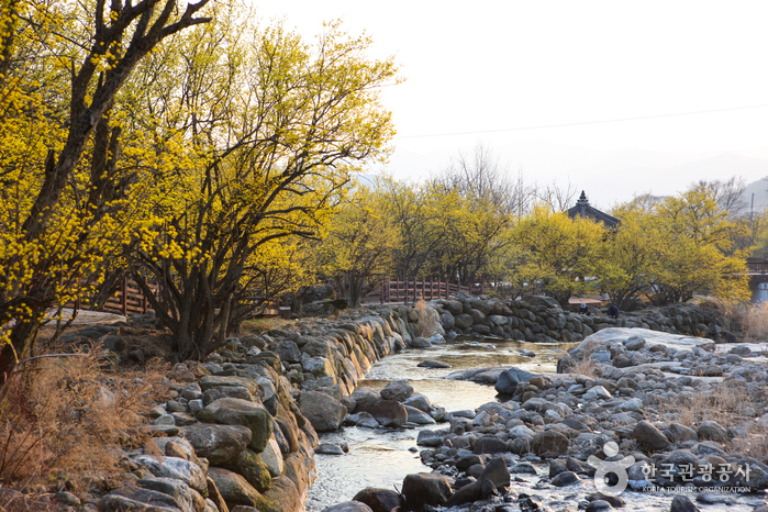
Gurye Sansuyu Village (구례 산수유마을)
2020-04-25
6-12, Wianwolgye-gil, Gurye-gun, Jeollanam-do
+82-61-783-9114
Sandong-myeon in the Gurye-gun region is widely known as the home of sansuyu (cornus fruit) and is responsible for 70% of Korea’s sansuyu fruit production. The Sansuyu Village, located at the foot of the southwest side of Manbokdae Mountain (1,433 meters), is considered the region’s most representative village of sansuyu. The village has a beautiful natural landscape with the snow-covered Jirisan Mountain range to its back and a small valley to its right.
Visitors to the village can wind down at the hot spring complex nearby, which is famous for its germanium content and said to have numerous health benefits. The sansuyu flowers of Sansuyu Village typically are at full bloom between March 20 and March 31, drawing throngs of visitors.
* Please note that blossom dates are not exact and change slightly from year to year.
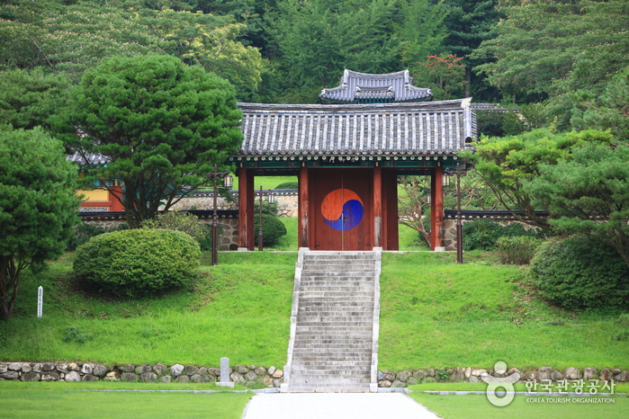
Nongae Shrine (Uiamsa Shrine) (논개사당(의암사))
2024-04-07
393, Hannuri-ro, Jangsu-gun, Jeonbuk-do
Uiamsa Shrine was built to the memory of Chu Nongae, who sacrificed her life during the Imjin War (Japanese Invasion of Korea). In 1846, the Nongae-saeng-jang-hyang-su-myeong-bi monument was put up in praise of Nongae’s patriotism. In 1955, a shrine was built and named Uiamsa, which was then moved to the current location in 1974. Within the precincts of the shrine are a memorial stone, the portrait of Nongae by artist Kim Eun-ho, and three gates Woesammun, Naesammun and Chunguimun erected one after another. At the memorial hall, the existing possessions of Nongae and her husband General Choi Gyeong-hoe are on display. The annual Nongae Festival takes places on September 3rd by the lunar calendar, during which memorial services and cultural events are held to commemorate Nongae.
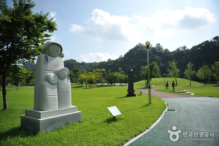
Saseondae Tourist Resort & Sculpture Park (사선대관광지&조각공원)
2024-04-07
68-7, Saseon 2-gil, Imsil-gun, Jeonbuk-do
Saseondae Tourist Area was established around the upper region of the Seomjingang River. The pine trees are dense, cherry blossoms bloom in spring, and autumn leaves are spectacular in fall in this area. At the Sculpture Park next to the Saseondae Tourist Area, visitors can enjoy sculptures by local sculptors and international artists from the nearby Ogung-ri Art Village.
Donguibogam Village (산청 동의보감촌)
2018-10-18
45-6, Donguibogam-ro 555beon-gil, Geumseo-myeon, Sancheong-gun, Gyeongsangnam-do
+82-55-970-7216
The Donguibogam Village (Sancheong Oriental Medicine Theme Park) was established in 2005 and is the first herbal medicine-themed park in Korea. This theme park was designed based on the five elements of the universe according to traditional Korean medicine. The village combines eco-friendliness and traditional Korean medicine content, using eco-friendly materials for various props and designs.

Oegosan Onggi Village (외고산옹기마을)
2026-03-17
36 Oegosan 3-gil, Ulju-gun, Ulsan
Oegosan Onggi Village was established when earthenware master Heo Deok-man settled in the area in 1975. The village today showcases a massive collection of various earthenware products, which creates a unique sight. Over 50% of the country's earthenware products are crafted at this village. The village also features several attractions for visitors to enjoy, such as the Ulsan Onggi Museum, which houses the largest earthenware pottery recognized by the Guinness Book of World Records; and the annual Ulsan Onggi Festival, with many diverse activity programs.
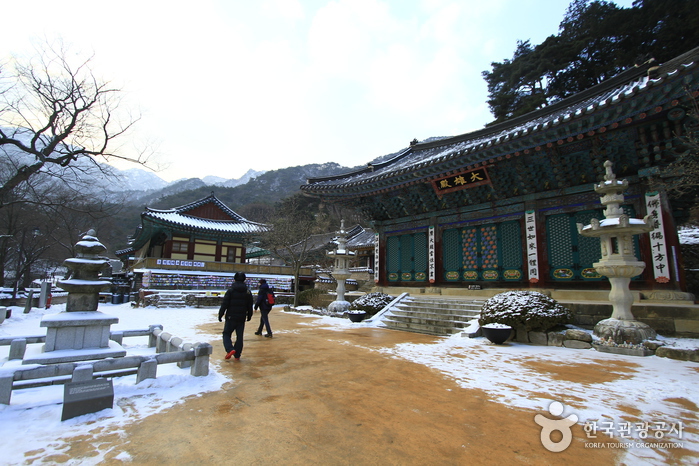
Gongju Donghaksa Temple (동학사(공주))
2020-03-16
462, Donghaksa 1-ro, Gongju-si, Chungcheongnam-do
+82-42-825-2570
Located in the east valley of Gyeryongsan Mountain in Hakbong-ri, Banpo-myeon, Gongju, Donghaksa Temple is the first and the oldest existing academic institute for female monks. Home to about 150 monks who study and practice Buddhism, the temple is the most visited spot on all of Gyerongsan Mountain due to its history, convenient location, and visitor facilities.
The elegant structure of the temple is x_heighted by the majestic view of Munpilbong Peak to its front. In the spring, many visitors come to the temple to see the cherry blossom tunnel, a 3 kilometer pathway from Bakjeongja three-way intersection to Donghaksa Temple. Every year since 1993 the temple has also been the venue of the Donghaksa Spring Flower Festival.
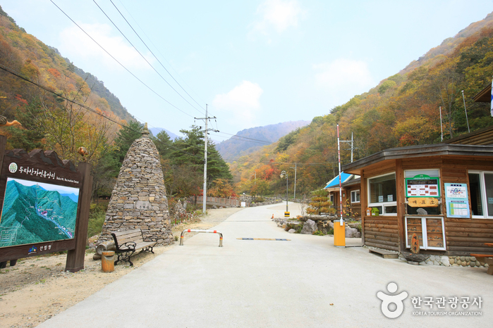
Dutasan National Recreational Forest (국립 두타산자연휴양림)
2021-03-04
132, Achagol-gil, Pyeongchang-gun, Gangwon-do
+82-33-334-8815
Dutasan National Recreational Forest is located at the foot of Dutasan Mountain, which rises 1,357 meters above the sea level and straddles the border between Jinbu-myeon of Pyeongchang-gun and Jeongseon-gun. The recreational forest is in the center of many popular attractions, including Odaesan National Park, Woljeongsa Temple, and beautiful valleys. The robust and rich forest is filled with a wide variety of animals such as badgers, raccoons, boars, and hares, as well as abundant medicinal herbs, and trees such as huge birch, nut trees and lime trees.

Daedunsan Provincial Park (Jeollabuk-do Section) (대둔산도립공원(전북))
2024-04-07
611-34, Sanbuk-ri, Wanju-gun, Jeonbuk-do
Daedunsan Mountain is defined by the grandiose rock peaks of Macheondae Summit, Chilseongbong, Janggunbong, and Ambong Peaks, as well as surrounding strange rocks and lush trees that fill the area including Samseonbawi Rock, Yongmungol Valley and Geumgangmun Gate. The area spanning from Macheondae Peak to Nakjodae Peak along the northern ridge offers a magnificent view, especially of the sunrise and sunset from Nakjodae.
Since its designation as a provincial park in 1977, Daedunsan Provincial Park has served as a scenic site equipped with recreational facilities including a cable car and Geumgang Suspension Bridge. A 5-minute cable car ride followed by a walk up the steep stairs leads to the suspension bridge, stretching 50 meters from Imgeumbawi Rock to Ipseokdae Pedestal. The park is also home to historic temples including Taegosa Temple of Jinsan, Ansimsa Temple of Unju, and Sinsounsa Temple of Byeolgok.
Hyundai Motors Ulsan Plant (현대자동차 울산공장)
2025-07-17
700, Yangjeong-dong, Buk-gu, Ulsan-si
Hyundai Motors Ulsan Plant is the world's largest single plant. It is made up of five independent factories, with approximately 32,000 personnel producing an average of 1,520,000 vehicles per year. The complex is 1.5 times bigger than the area of Yeouido, and owns a port where they ship out maximum of 4,500 vehicles per day.
 English
 한국어
한국어 日本語
日本語 中文(简体)
 Deutsch
 Français
 Español
 Русский