Asan-si Hot Springs Special Tourist Zone (아산시 온천 관광특구)
2024-03-15
1459 Oncheon-daero, Asan-si, Chungcheongnam-do
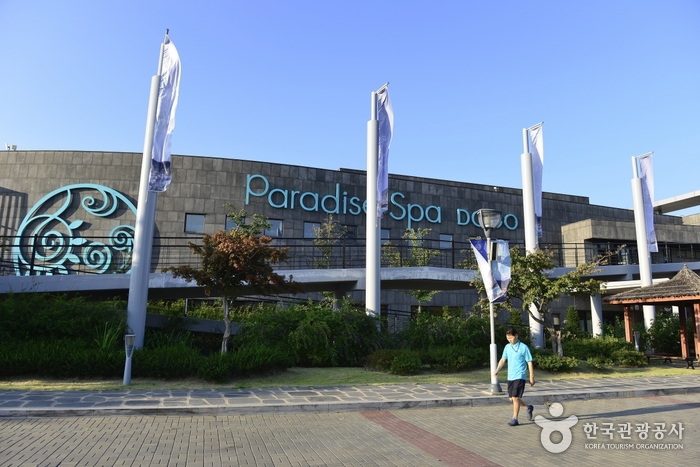
The Asan-si Hot Springs Special Tourist Zone encompasses three major hot springs: Onyang, Dogo, and Asan Hot Springs. Onyang Hot Springs is the oldest hot springs complex in Korea, and Dogo Hot Springs is famous as a therapeutic destination. Asan Hot Springs is situated north of Asan and features a unique water park that utilizes the natural hot springs water. All three locations are equipped with hotels that provide guests with direct access to the therapeutic waters.

Suanbo Hot Springs Special Tourist Zone (수안보온천 관광특구)
2026-03-11
12 Jujeongsan-ro, Suanbo-myeon, Chungju-si, Chungcheongbuk-do
Suanbo Hot Springs, in existence for nearly 30,000 years, feature weak alkaline water with a temperature of 53°C that originates from 250 meters below ground. The water is rich in substances beneficial to the human body. Visitors can enjoy the hot springs at hotels or resorts, as well as in public baths, outdoor baths, and family baths. Other attractions in the area include the Suanbo Insect Museum, a traditional market, and Multang Park.
Songnisan Special Tourist Zone (속리산 관광특구)
2025-01-14
405, Beopjusa-ro, Boeun-gun, Chungcheongbuk-do
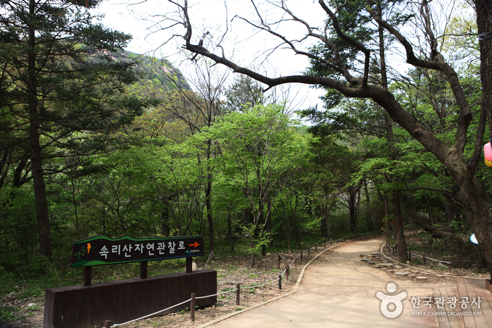
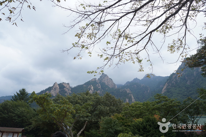
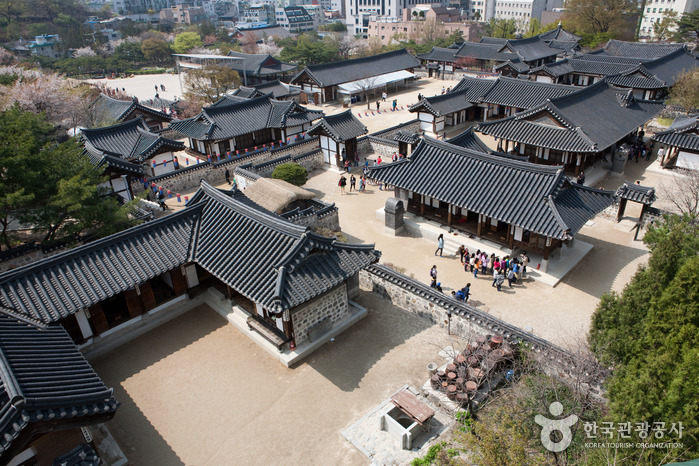
With Songnisan National Park at its center, Songnisan Special Tourist Zone offers picturesque scenery and cozy resorts. At 1,058 meters above sea level, Songnisan Mountain is one of the 8 scenic wonders in Korea, and its steep peaks and deep valleys create a fascinating view. A variety of hiking trails that set out from Beopjusa Temple offer superb mountain scenery from every angle.
A tourism complex around Songnisan National Park offers various types of accommodations, and the area's attractions, such as Beopjusa Temple, Seowongyegok Valley, Mansugyegok Valley and Solhyang Park are not to be missed. In fact, the mountain is a habitat for rare animals and plants, including flying squirrels and Berchemia Berchemiaefolia, and is called a “treasure house of natural resources.”
The convenient accessibility should be noted as well. The highway between Dangjin and Yeongdeok goes through the zone, and it takes only 30 minutes from Cheongju International Airport. This helps foreign tourists from China, Taiwan and Singapore as well as Korean visitors to easily access the zone.
A variety of events, including the Songni Festival, the Songnisan Maple Music Festival and the Songnisan Hiking Festival, are held every year, and the largest number of tourists visit in autumn to appreciate a view of the mountain tinged with red.
* Current State of Songnisan Special Tourist Zone
1) Districts Covered: Areas around Sangpan, Jungpan, Galmok and Sanae-ri, Songnisan-myeon, Boeun-gun, Chungcheongbuk-do
2) Area: 43,745,528 ㎡
Seorak Special Tourist Zone (설악 관광특구)
2020-03-25
Sokcho-si, Gangwon-do
+82-33-249-2775
Seorak Special Tourist Zone is a vast zone included in 3 administrative districts, encompassing the entirety of Seoraksan Mountain. In this zone, visitors have various ways to enjoy Seoraksan Mountain and the natural environment of the East Sea region.
Sokcho, which occupies the largest area in the zone, comes first when talking about Seoraksan National Park. Tourists can appreciate the picturesque scenery of the sea and coastal lakes as well as the mountain scenery of Seoraksan Mountain. Hikers can climb the mountain or ride a cable car. Sokcho Beach is a hot spot that attracts young people who fill the place with energy and life all through the summer.
Abai Village, which appeared in several TV dramas for its unique atmosphere, and Sokcho Jungang Market offer local specialties, such as abai sundae (Korean sausage) and dak gangjeong (glazed fried chicken bites).
Goseong, which is bordered by Seoraksan Mountain and Geumgangsan Mountain, is part of the Northern Limit Line (NLL) that offers a unpolluted, beautiful landscape around the Demilitarized Zone (DMZ). Hwajinpo Beach near Hwajinpo Lake, which is a lagoon, and Songjiho Beach near Songjiho Lake are the best places to spend a peaceful vacation. At Hwajinpo Lake, tourists can visit the summer house used by the first South Korean President Syngman Rhee and Castle of Hwajinpo, visited by the former North Korean leader Kim Il-sung before the division of the Korean Peninsula. Lastly, although it is a relatively small part of Seorak Special Tourist Zone, Yangyang has resources for mountain tourism and maritime culture, such as Seoraksan National Park and Naksan Provincial Park. Naksan Beach, Naksansa Temple and Hajodae are popular tourist sites. It is also famous as a district producing high quality pine mushroom.
* Current State of Seorak Special Tourist Zone
1) Districts Covered: Areas around Sokcho-si and parts of Goseong and Yangyang-gun, Gangwon-do
2) Area: 138.2k㎡(Sokcho 104.9k㎡, Goseong 30.5k㎡, Yangyang 2.8k㎡)
* Tourist Attractions
Seoraksan National Park, Sokcho Beach, Naksan Provincial Park, Hwajinpo Lake, Songjiho Lake, Hajodae Pavilion, Naksansa Temple, Osaek Mineral Spring, etc.
Bugok Hot Springs Special Tourist Zone (부곡온천 관광특구)
2024-02-27
77 Oncheonjungang-ro, Bugok-myeon, Changnyeong-gun, Gyeongsangnam-do
Bugok, named after its cast-iron pot-like terrain, boasts the hottest spring in Korea with a temperature of 78°C. It features various attractions such as Hanol Park and fountain park for performances, a refreshing trail, golf courses, and foot baths. Bugok Hot Springs is believed to be effective for arthritis, skin diseases, and fatigue recovery. Nearby attractions include Uponeup Marsh, Hwawangsan Mountain, and the Gaya Tombs.
Boryeong Beach Special Tourist Zone (보령 해수욕장 관광특구)
2021-07-13
Boryeong-si, Chungcheongnam-do
The Boryeong Beach Special Tourist Zone consists of three major attractions: Daecheon Beach, Muchangpo Beach and Jukdo Island.
The 3.5-kilometer-long, 100-meter-wide Daecheon Beach is popular as the main venue for the annual Boryeong Mud Festival, which attracts about 2 million domestic and international tourists every year. The soft, white sand and lush pine trees also make this an ideal beach to visit for a walk. Various accommodations can easily be found here since the area has been a popular tourist destination for quite some time.
Located south of Daecheon Beach, Muchangpo Beach is where visitors can witness a sea-parting phenomenon in the summer. The 1.5-kilometer “Mystic Sea Road” between Muchangpo Beach and Seokdaedo Island reveals itself when the water levels go down due to the difference in the ebb and flow of the tides. During the sea parting, visitors will be able to catch clams, crabs and shellfish. The beach also offers a breathtaking view of the sunset.
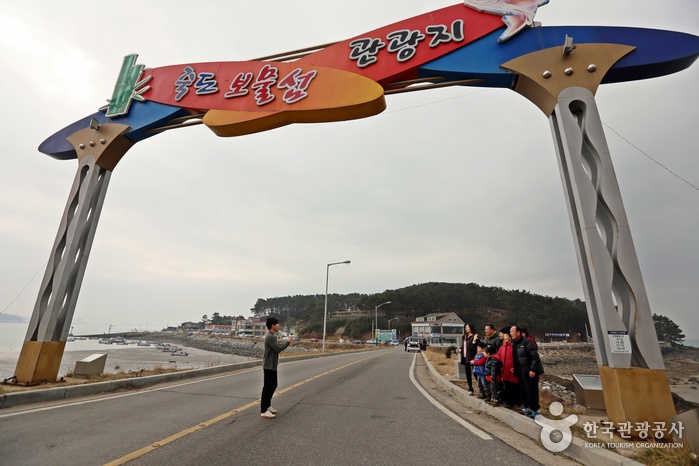
Jukdo Island is located midway between Daecheon Beach and Muchangpo Beach. This unpopulated fishing island is known for its dense groves of bamboo trees. The waters in front of the island are clean and full of fish, drawing a large number of visitors for sea fishing.
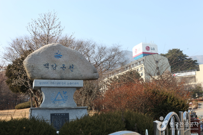
Baegam Hot Springs Special Tourist Zone (백암온천 관광특구)
2021-06-12
Uljin-gun, Gyeongsangbuk-do
At the Baegam Hot Springs Special Tourist Zone, visitors can enjoy both the lush mountain terrain of the Baekdudaegan Mountain Range and the magnificent scenery of the East Sea.
The hot springs of Baegam are one of the most popular tourist attractions in the region and are visited by travelers from across the nation. The water temperature reaches as high as 53 degrees Celsius and contains various minerals and elements, including a strong alkaline content. This makes the water effective in treating neuralgia, arthritis and apoplexy. Recently, it was reported that the water is also beneficial for those with atopic dermatitis, thereby attracting the elderly and families. Recreational facilities for children are also available.
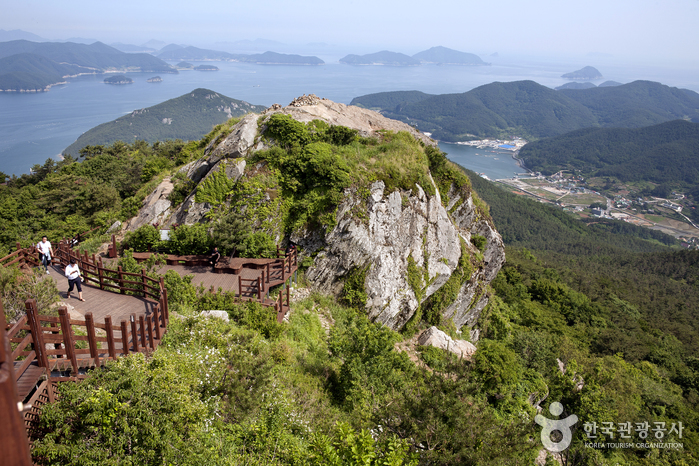
The hot springs are located at the foot of the 1,004-meter-high Baegamsan Mountain. The mountain trails lead to Yeongyang and Bonghwa and are frequented by hikers. Densely covered with pine trees, the mountain also has plenty of deep valleys. Sinseon Valley, where,
according to legend a dragon once lived, has an abundance of water flowing in different directions.
In the vicinity are Jukbyeon Port and Hupo Port, which are known for snow crabs, and Mangyangjeong Pavilion and Wolsongjeong Pavilion where one can enjoy a beautiful view of the sea.
[Baegam Hot Spring Special Tourist Zone]
Areas Covered: Onjeong-ri and Sotae-ri, Onjeong-myeon, Uljin-gun, Gyeongsangbuk-do
Area size: 1,740,000㎡
Tourist attractions: Hot Spring Town, Baegamsan Mountain, Sinseon Valley, etc.
Mireukdo Island Special Tourist Zone (미륵도 관광특구)
2021-08-17
Donam-dong, Tongyeong-si, Gyeongsangnam-do
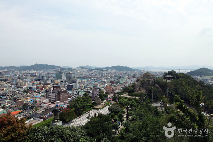
Mireukdo Island is located in Tongyeong, a city that holds great historical significance for being the home of the Tongjeyeong naval station during the Joseon dynasty. The Tongyeong base served as the central command station for the three other naval bases in the Gyeongsang, Jeolla and Chungcheong regions.
Not only is Mireukdo Island designated as a Special Tourist Zone, it is also a part of the Hallyeohaesang National Park and serves as the center of tourism in the South Coast. The Mireukdo Special Tourist Zone, with the Donam Tourist Complex as its core, is well-equipped with a variety of leisure facilities, tourist accommodations and restaurants. This district caters to visitors with yacht services and a variety of water sports such as windsurfing, kayaking and water skiing. Exceptionally popular is the ferry cruise that takes visitors to Hansando Island, which is located just off the coast of Tongyeong, and to the other scenic islands such as Bijindo and Maemuldo.
Mireukdo Island is connected to Tongyeong through an undersea tunnel, Chungmu Bridge and Tongyeong Bridge, making it even more accessible to visitors. At the center of the island is the towering Mireuksan Mountain. The panoramic Hallyeosudo Viewing Ropeway, which opened in 2008, takes visitors to the summit of Mireuksan Mountain. The top offers a commanding view of the forests and valleys below. On a clear day, visitors can even see the Japanese island of Tsushima. The mountain’s hiking trails are well-maintained and are suitable for short hikes. The most traveled trail is the one starting from Yonghwasa Temple. Hikers taking this trail pass through Gwaneumsa Temple and Mireukjae Pass to reach the top. The trail leads to Miraesa Temple and a grass field on the way down before finally going back to Yonghwasa Temple.
[Mireukdo Special Tourist Zone]
Areas Covered: Part of Sanyang-eup (Mireukdo Island and Obido Island), areas of Misu-dong, Bongpyeong-dong and Donam-dong in Tongyeong-si, Gyeongsangnam-do
Area size: 32,900,000 ㎡
Tourist Attractions: Hallyeosudo Viewing Ropeway, Ferry Cruise, Tongyeong Concert Hall, Undersea Tunnel
Mokpo Special Tourist Zone (목포 관광특구)
2024-03-08
Mokpo-si, Jeollanam-do
Mokpo Tourism Special Zone spans a 6.9km stretch from the North Port to Yudalsan Mountain, old downtown area, Samhakdo Island, Gatbawi Rock, and the Peace Plaza in the new city center. It features historical sites from the Japanese colonial era, such as the Former Japanese Consulate and Mokpo History and Culture of Modern Times. Visitors can explore attractions like the Mokpo Natural History Museum and the Korea National Maritime Museum. Being a coastal city, Mokpo offers a variety of seafood dishes including sliced raw croaker, braised cutlassfish, skate, pork, and kimchi combo, raw thin-legged octopus, and blue crab salad.
Myeong-dong, Namdaemun, Bukchang-dong, Da-dong and Mugyo-dong Special Tourist Zone (명동 남대문 북창동 다동무교동 관광특구)
2021-12-30
40, Sejong-daero, Jung-gu, Seoul
Myeong-dong, Namdaemun, Bukchang-dong and Da-dong are widely known among international visitors as hot spots for shopping and food.
Myeong-dong is a popular destination for shopping, culture, arts and fashion. Major shopping malls such as Lotte Department Store, Shinsegae Department Store, Myeong-dong Migliore and Samik Fashion Town are located here. Shoppers can find a variety of products here from high-end items to relatively inexpensive clothes. There’s also no shortage of street food, traditional restaurants, coffee shops and fancy cafes.
Namdaemun Market is the biggest traditional market in Korea. Visitors can purchase souvenirs and local produce at an affordable price in the shopping complex crowded with stores and street stalls. The market sells a variety of clothes, kitchenware, toys, accessories, food, flowers and imported goods.
Bukchang-dong and Sogong-dong have high-end accommodations including Lotte Hotel Seoul and Westin Chosun Seoul, duty-free shops, and restaurants serving traditional dishes.
[Myeong-dong, Namdaemun Market and Bukchang-dong Special Tourist Zone]
Areas included: Myeong-dong, Bukchang-dong, Mugyo-dong and Da-dong, Seoul
Area size: 872,809 ㎡
Tourist attractions: Myeong-dong, Namdaemun Market and Bukchang-dong, Department Stores (Lotte Department and Shinsegae Department Store, etc.), Traditional Market, Duty-free Shop, Hanok Village, N Seoul Tower, etc.
 English
 한국어
한국어 日本語
日本語 中文(简体)
 Deutsch
 Français
 Español
 Русский