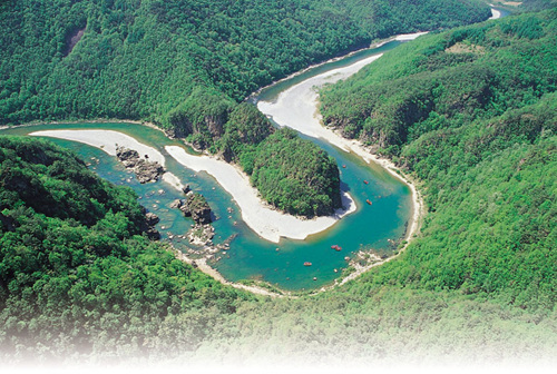
Eorayeon Valley -Gangwon Paleozoic Geopark (어라연-강원고생대 국가지질공원)
11.5Km 2022-12-29
259 , Eorayeon-gil, Yeongwol-gun, Gangwon-do
A beautiful and mysterious valley located 12 km up the Donggang River, Eorayeon Valley is renowned for its clean waters and for the many fish that inhabit it. The valley has beautiful rock formations and a dense pine forest that were designated as the National Scenic Spot in December 2004. It is one of Korea's most popular sites for rafting, followed by Naerincheon Creek and Cheorwon's Hantangang River. The trail to Eorayeon through Jatbong Peak is also quite popular (approx. 3 hours).
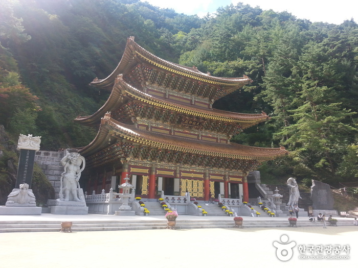
Guinsa Temple (Danyang) (구인사(단양))
11.9Km 2024-03-15
73 Guinsa-gil, Yeongchun-myeon, Danyang-gun, Chungcheongbuk-do
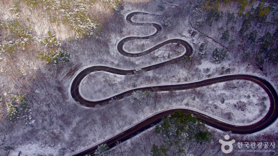
Danyang Bobaljae Pass (단양 보발재)
11.9Km 2024-02-26
San 26-7, Baekja-ri, Yeongchun-myeon, Danyang-gun, Chungcheongbuk-do
Bobaljae Pass is located 540 m above sea level on the northern side of Sobaeksan Mountain. It is also known as Godeuneomijae Pass. The S-shaped curve is known for wildflowers in spring and fall foliage in autumn, so one can either take a leisurely drive along the road or park one’s car at the observatory and get some pictures. Guinsa Temple and Ondal Tourist Area nearby are also good to visit.
![Seondol Cliff [National Geopark] (선돌 (강원고생대 국가지질공원))](http://tong.visitkorea.or.kr/cms/resource/00/2026100_image2_1.jpg)
Seondol Cliff [National Geopark] (선돌 (강원고생대 국가지질공원))
12.3Km 2022-12-28
373-1, Bangjeol-ri, Yeongwol-gun, Gangwon-do
Seondol Cliff features a large split rock standing over the curving river below. The scene created by these two natural elements appears other-worldly. A rocky outcrop appears to have been cut away from the main cliff with a giant knife. Geologically, it was formed by corrosion of the limestone bedrock.

Pyeongchang Eoreumchi Village (평창 어름치마을)
17.9Km 2024-02-16
42-5 Maha-gil, Mitan-myeon, Pyeongchang-gun, Gangwon-do
Pyeongchang Eoreumchi Village is dedicated to preserving the habitat of the Eoreumchi (Cyprinid Fish), a natural monument that thrives in pristine environments. The village offers immersive rural experiences and ecotourism activities. Visitors have the opportunity to engage in water sports like rafting and kayaking on the Donggang River, as well as mountain climbing on Baegunsan Mountain. Other activities include trekking through Chiljokryeong and exploring the Baengnyongdonggul Cave. Reservations for these experiences can be made through their website.
![Korean Peninsula Terrain [National Geopark] (한반도지형 (강원고생대 국가지질공원))](http://tong.visitkorea.or.kr/cms/resource/57/2517657_image2_1.jpg)
Korean Peninsula Terrain [National Geopark] (한반도지형 (강원고생대 국가지질공원))
19.4Km 2024-04-08
555 Hanbando-ro, Hanbando-myeon, Yeongwol-gun, Gangwon-do
Korean Peninsula Terrain was formed by soil transported from upstream to the curvature of the confluence of two rivers. It is often referred to as Mini Korean Peninsula because it resembles the shape of the Korean Peninsula. It is said to have this appearance due to the erosion of the incised stream flowing around the terrain. It takes a 15-minute walk along the pine forest trail for about 800 meters from the parking lot to reach there. The well-maintained trail with many wildflowers and plants creates a welcoming atmosphere. Upon arriving at the observation point, visitors will be amazed by the beautiful curved river and the topography taking the same shape as the Korean Peninsula. Designated as the Gangwon Paleozoic National Geopar, this area has excellent geographical value because it shows the characteristics of the incised mender river as well.
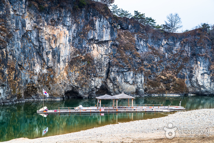
Hanbando Raft Village (한반도 뗏목마을)
19.6Km 2024-01-09
70 Seonam-gil, Hanbando-myeon, Yeongwol-gun, Gangwon-do
The Hanbando Raft Village is a raft experience center in Seonam Village, Ongjeong-ri, famous for its topography in the shape of the Korean Peninsula. It takes about 30 minutes to go back and forth on a raft from the east coast of the Mini Korean Peninsula to the west coast. While riding the raft, the boatman tells the story of the topography of the Mini Korean Peninsula and the fish living here. It is available from spring to autumn. In addition, various raft experiences are under operation, such as the Seogang Underwater Surveyor, a remodeled rafting boat that allows you to clearly view the underwater scenery.
![Buseoksa Temple [UNESCO World Heritage] (부석사[유네스코 세계문화유산])](http://tong.visitkorea.or.kr/cms/resource/22/2654222_image2_1.jpg)
Buseoksa Temple [UNESCO World Heritage] (부석사[유네스코 세계문화유산])
20.0Km 2024-02-28
345 Buseoksa-ro, Buseok-myeon, Yeongju-si, Gyeongsangbuk-do
Founded in 676, Buseoksa Temple is a temple located on the eastern slope of Sobaeksan Mountain. It was established to commemorate the victory of the Silla kingdom (BC 57-AD 935) over the Chinese Tang dynasty during a war at that time. Over the years, it underwent several reconstructions and expansions, resulting in the preservation of numerous cultural assets. Particularly, the "Muryangsujeon Hall" is regarded as one of the most beautiful traditional architectural structures in Korea.
 English
 한국어
한국어 日本語
日本語 中文(简体)
 Deutsch
 Français
 Español
 Русский


