
Shifting Cultivation Bom Bom Festival (화전민 봄봄축제)
17.5Km 2025-06-10
922-8 Gwangseok-ro, Duchon-myeon, Hongcheon-gun, Gangwon-do
+82-507-1433-8930
Shifting Cultivation Bom Bom Festival takes place in Bahoe Village, a small farming village in Hongcheon-gun, Gangwon State. It is a farming experince program that includes trekking along the crystal clear stream of Yongsogyegok Valley and an activities that provide insight on shifting cultivation and the farmers' lifestyles. Participants can enjoy a guided tour, take part in farming activities, pick crops, and try a local meal made from fresh ingredients.
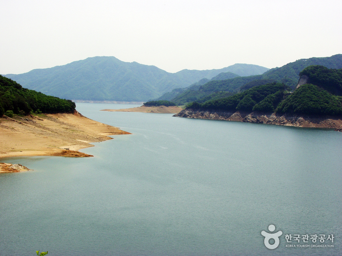
Soyangho Lake (Yanggu Section) (소양호(양구))
18.7Km 2023-09-14
Seokhyeon-ri, Yanggu-gun, Gangwon-do
Soyangho Lake is a man-made lake that was created when Soyang Dam, the biggest rock-filled dam in Asia, was built in 1973. The lake is a hotspot for aquatic tourism and the lakeside road is an important route that connects Chuncheon and Yanggu. It is also a popular fishing spot as over 50 types of fishes can be found.
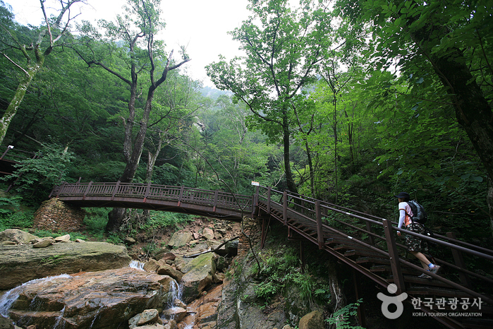
Seoraksan Heullimgol Valley (설악산 흘림골)
19.4Km 2024-02-16
San1-71, Osaek-ri, Seo-myeon, Yangyang-gun, Gangwon-do
Yangyang’s Heullimgol Valley, named for its cloud-like, foggy appearance due to the surrounding high mountains and deep valleys, offers a spectacular view and serves as the gateway to Deungseondae. This spot provides an expansive view of the southern side of Seoraksan Mountain. Notable sites near Heullimgol Valley include Yeosimpokpo Falls, Deungseondae, Deungseonpokpo Falls, Geumgangmun Gate, and Jujeongol Valley. Access to Heullimgol Valley is strictly limited to 5,000 visitors per day, with entry based on time reservations. Therefore, visitors must make a reservation through the Korea National Park Service's reservation system before visiting.
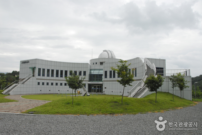
Center of Korea Observatory (국토정중앙천문대)
19.4Km 2021-08-12
127, Guktojeongjungang-ro, Yanggu-gun, Gangwon-do
The Center of Korea Observatory in Yanggu-gun is named for its location at the center of the Korean Peninsula. It is equipped with an 80-centimeter reflecting telescope. There is also an exhibition hall providing the most recent astronomy news, a planetarium showing the night sky, and a range of hands-on programs.
 English
 한국어
한국어 日本語
日本語 中文(简体)
 Deutsch
 Français
 Español
 Русский