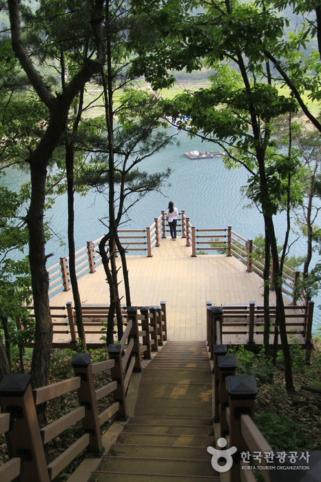
Jongdaengi Trail (충주호 종댕이길)
19.0Km 2025-03-17
Jongmin-dong, Chungju-si, Chungcheongbuk-do
Simhangsan Mountain, located adjacent to Chungjuho Lake, is affectionately known as Jongdaengi Mountain due to the presence of a shrine. The construction of Chungju Dam in 1985 led to the formation of Chungjuho Lake and the subsequent disappearance of a village. The Jongdaengi Trail, a scenic walking path along Simhangsan Mountain, offers breathtaking views of Chungjuho Lake. Along the trail, visitors can discover an ecological pond and a suspension bridge, enhancing the overall experience.

Chungju Mireukdaewon Stone Temple Site (충주 미륵대원지)
19.4Km 2021-03-19
150, Mireungnisaji-gil, Chungju-si, Chungcheongbuk-do
+82-43-850-6724
Mireukdaewon Stone Temple Site, Historic Site No. 317, faces south in the basin of the Haneuljae Pass between Chungcheongbuk-do and Gyeongsangbuk-do. It is said that Mauitaeja, the last prince of the Silla Kingdom, had a dream one night as he was traveling to Geumgangsan Mountain where the Avalokitesvara Bodhisattva instructed him to erect a statue of Buddha. As a result, he built a temple to honor the goddess’ wish at the current site of Mireuk-ri. The temple name was discovered through excavation research in 1977 and 1978 by Cheongju University, while the temple grounds were more thoroughly investigated by a team of researchers from Ewha Woman's University in 1980.
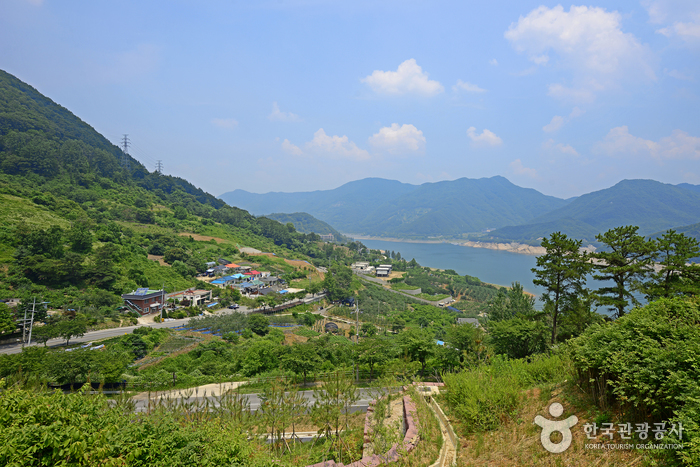
Gyemyeongsan Recreational Forest (계명산자연휴양림)
19.5Km 2022-09-07
1170, Chungjuhosu-ro, Chungju-si, Chungcheongbuk-do
+82-43-870-7930
Gyemyeongsan Recreational Forest is located on Gyemyeongsan Mountain, part of the Sobaeksan Mountain Range, and has outstanding views of Chungjugho Lake. Although the park is small in size, the recreational forest provides a peaceful and relaxing getaway with lush pine tree forest along with diverse animals and plants. The trees are great for forest bathing, and are beautiful in autumn when the leaves turn crimson. <BR>
Nearby attractions include Suanbo Hot Springs, Songnisan Mountain, Eight Sights of Danyang, and Chungjuho Lake. The park also has log cabins, providing a unique type of accommodation.
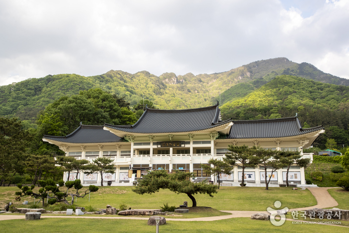
Museum of Old Roads (옛길박물관)
19.5Km 2023-07-28
944, Saejae-ro, Mungyeong-si, Gyeongsangbuk-do
+82-54-550-8372
The Museum of Old Roads offers the history of traditional roads and routes in Korea. In the past, Mungyeongsaejae was a transportation hub for the people of Korea, particularly during the Joseon Period. Mungyeongsaejae is home to Haneuljae (one of the oldest roads in Korea, first established in 156 AD), Tokkibiri (a famous trade route), and Yugok Station (a transport hub in the Yeongnam area).
Even though the importance of the roads as travel routes has diminished over time, they continue to increase in cultural significance, conveying the area’s rich traditional heritage to visitors. The Museum of Old Roads was opened in 2009 after having been remodeled from the Mungyeongsaejae Museum, which mainly dealt with local history.
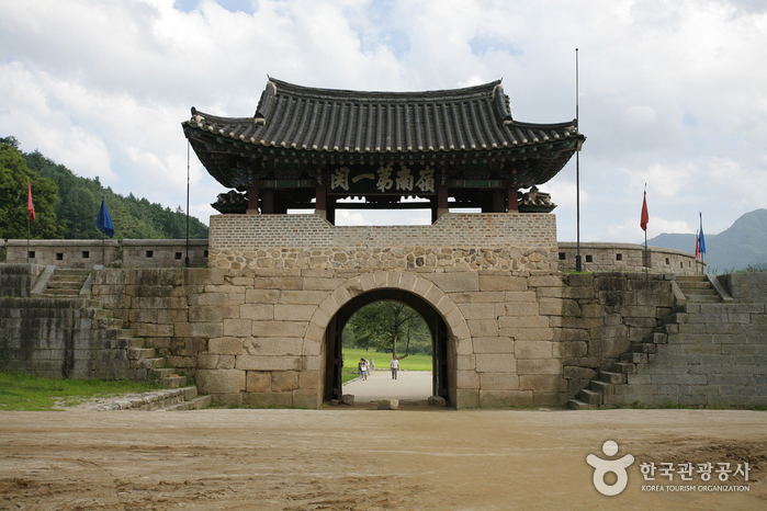
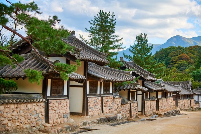
Mungyeongsaejae Provincial Park (문경새재도립공원)
19.6Km 2023-02-13
932, Saejae-ro, Mungyeong-si, Gyeongsangbuk-do
+82-54-571-0709
Mungyeongsaejae Pass, which crosses Joryeongsan Mountain, has always been the highest and most dangerous mountain pass in Korea, being reputed to be too tall for even birds to fly over. The three gates of Juheulgwan, Jogokgwan, and Joryeonggwan were built for national defense after the Imjin War (1592-1598). These three gates are designated collectively as Historic Site No. 147. The area between the three gates was designated a provincial park in 1981. The path from the first gate to the last passes through beautiful forests and takes roughly four hours round-trip. Also located within the park boundaries is Mungyeongsaejae Open Set, used for filming historical dramas.

Mungyeong Chasabal Festival (문경찻사발축제)
19.6Km 2025-07-11
932 Saejae-ro, Mungyeong-si, Gyeongsangbuk-do
+82-54-571-7677
Home to many ceramic masters and artisans, Mungyeong holds the Mungyeong Chasabal (Tea Bowl) Festival every year to honor and develop traditional Korean pottery and ancestral craftsmanship. The festival holds an exhibit with more than 200 kinds of high-quality and high-end ceramics and an online auction of luxury tea bowls. There is also a performance, “A Day of a Mungyeong Potter,” in which craftsmen tell stories and provide explanations behind their tea bowls to add fun and content to the festival. Visitors can mold their own clay and make tea bowls, and children can partake in various programs, such as playing with clay and performing a tea ceremony.
◎ Chasabal
Chasabal, also known as dawan, is a bowl used for drinking tea. Mungyeong’s traditional tea bowl is made in a firewood kiln called “Mangdaengi,” which uses wood rather than modern gas or electric kilns to make a fire.
Mungyeongsaejae Open Set (문경새재 오픈세트장)
19.6Km 2024-07-18
932, Saejae-ro, Mungyeong-si, Gyeongsangbuk-do
Mungyeongsaejae Open Set has been used for a variety of historical publications, including “Taejo Wang Geon (2000),” “Dae Jo Yeong (2006),” “Sungkyunkwan Scandal (2010),” “Moon Embracing the Sun (2012),” “Jeon Woo-chi (2012),” and “Masquerade (2012).” In 2008, the Goryeo Dynasty set was dismantled and redesigned into a Joseon-era set. Visitors can get a glimpse of life in the past through the replica houses and various structures throughout the open set.
Mungyeongsaejae Open Set (문경새재 오픈세트장)
19.6Km 2025-10-24
932 Saejae-ro, Mungyeong-si, Gyeongsangbuk-do
This open set is a filming location for popular historical dramas such as "Kingdom (2019)," "The Red Sleeve (2021)," and "The Moon Embracing the Sun (2012)," and is connected to Mungyeong Provincial Park. One of the most famous spots is the Gwanghwamun Set, which vividly embodies Gwanghwamun Gate. The set has various settings such as a hanok village, downtown area, and a common people's village, spread over a large site, making visitors feel as if they have traveled back in time to the Joseon dynasty.
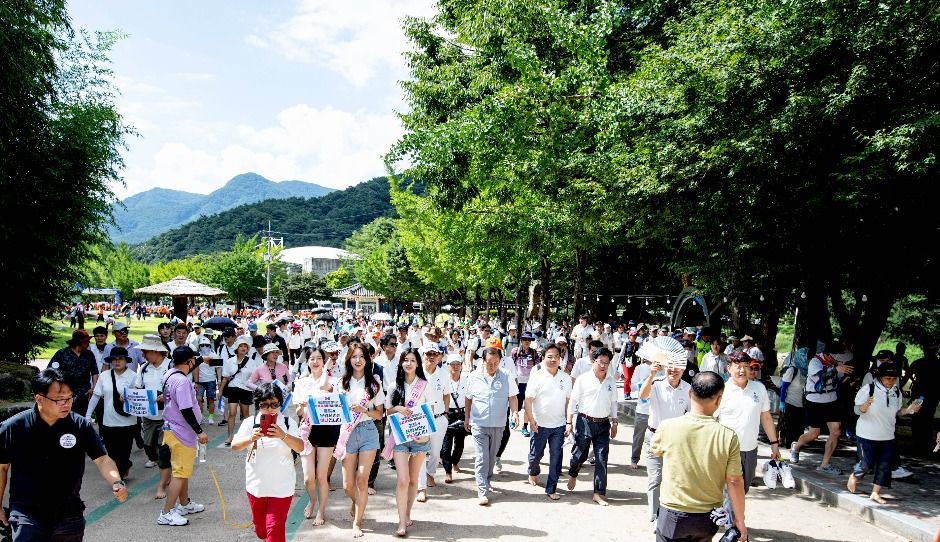
Mungyeong Saejae Bare-foot Walking Festival (오감만족 문경새재맨발페스티벌)
19.6Km 2025-05-16
932 Saejae-ro, Mungyeong-eup, Mungyeong-si, Gyeongsangbuk-do
+82-53-755-5881
The festival, held annually in Mungyeong, is a bare-foot walking festival covering approx. 7km. During the festival a main performance, various event booths, bare-foot-walking events, and a singing contest are held, allowing visitors to enjoy the festivities while keeping an eye on their health.
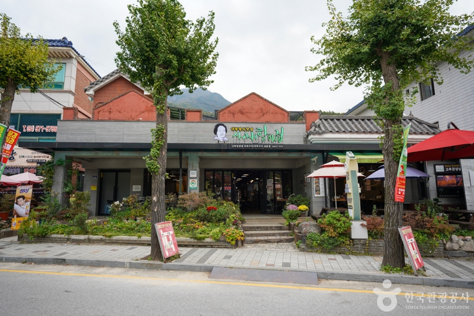
Saejae Halmaejip (새재할매집)
19.7Km 2024-02-23
922 Saejae-ro, Mungyeong-eup, Mungyeong-si, Gyeongsangbuk-do
054-571-5600
Nestled in Mungyeongsaejae Provincial Park, Saejae Halmaejip is a Korean restaurant celebrated for its gochujang yangnyeom seoksoe gui (grilled red chili paste marinated meat). The menu also features deodeok gui (grilled deodeok), pajeon (green onion pancake), and dotorimuk (acorn jelly salad), which perfectly complement the signature gochujang yangnyeom seoksoe gui. This long-standing establishment, favored by many regular customers, has also made appearances in several TV shows.
 English
 한국어
한국어 日本語
日本語 中文(简体)
 Deutsch
 Français
 Español
 Русский