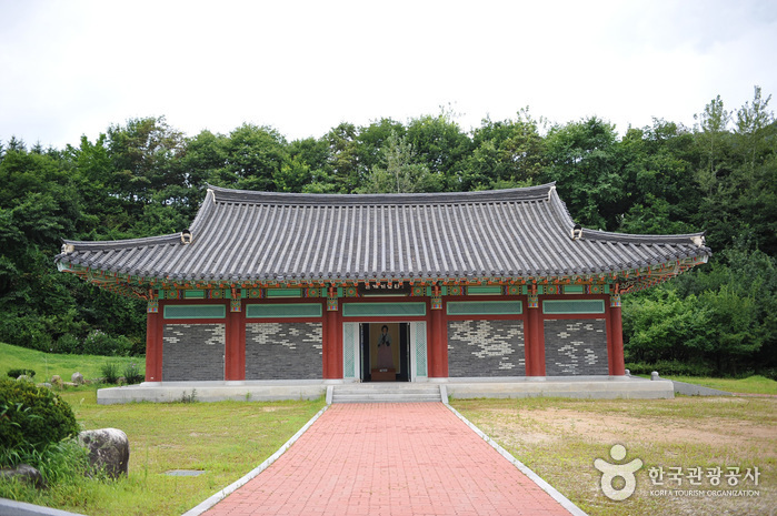
Namwon Silsangsa Temple (실상사(남원)) - Area information - Korea travel information

Namwon Silsangsa Temple (실상사(남원))

Namwon Silsangsa Temple (실상사(남원))

14.2Km    2024-04-07

94-129, Ipseok-gil, Namwon-si, Jeonbuk-do
+82-63-636-3031

Silsangsa Temple was constructed by Monk Jeunggak, as one of nine special temples in the year 828. The temple was established because of the theory of divination, based on topology. The belief held that Korea’s good spirit would be taken away to Japan, bringing bad luck if the temple was not constructed at this particular location. The temple was reconstructed in the 26th year of King Sukjong’s reign (1700) after it was completely destroyed during the Imjin War (1592-1598). However, it was almost burnt down in the 19th year of King Gojong’s reign (1882).

It is presently preserved just as it was during the Unified Silla Kingdom, with its three-story pagoda and its 11 treasures with a total of 17 cultural assets. The entrance of the temple lies in the middle of a rice field and the temple has a pastoral view, surrounded by trees. From the entrance, visitors can cross the half-moon shaped stone bridge to find a remarkable totem pole.

Jirisan Hanok Village (지리산한옥마을)

Jirisan Hanok Village (지리산한옥마을)

14.5Km    2024-12-24

43 , Daejeongbangcheon-gil, Namwon-si, Jeonbuk-do
+82-63-636-1003, +82-10-8107-1838

Jirisan Hanok Village, in Namwon-si, Jeollabuk-do, is a famous old house at the foot of Jirisan National Park’s Cheonwangbong and Nogodan Peaks. Just 20 minutes by car away from Nogodan and Baemsagol Valley Trail, the place is popular with walkers especially in the summer. Businessmen, poets and writers come here for the beautiful scenery; in particular, a candidate for the 2008 Nobel Prize in Literature stayed and worked here for a while.

Seoamjeongsa Temple (서암정사(함양))

14.6Km    2024-02-21

27-79 Gwangjeom-gil, Macheon-myeon, Hamyang-gun, Gyeongsangnam-do

Seoamjeongsa Temple belongs to Byeoksongsa Temple, which is at the entrance of the Chilseongyegok Valley of Jirisan Mountain. Monk Woneung rebuilt Byeoksongsa Temple, which had been damaged during the Korean War in 1950. This hermitage features the Buddha statues Woneung carved into the natural bedrock, a grotto sanctuary with statues of the Pure Land, Daebanggwangmun Gate, and Sajagul Cave.

Baraebong Peak (바래봉)

Baraebong Peak (바래봉)

17.0Km    2024-04-07

196, Baraebong-gil, Namwon-si, Jeonbuk-do
+82-63-630-8900

Baraebong Peak gets its name from its resemblance to an upside down barittae (a wooden rice bowl used by temple priests). The mountain is characterized by round slopes and fields of royal azalea flowers in spring. Trekking starts at Yongsan Village, 1.5 kilometers away from Unbong-eup. The trail follows a gentle path through a forest reserve behind a ranch and up to the peak. The last section of the trail before reaching the summit is covered in royal azaleas in full bloom from late April until May. The view from the peak includes the whole vista of Jirisan Mountain.

Jirisan National Park (Hamyang Section) (지리산국립공원(함양))

Jirisan National Park (Hamyang Section) (지리산국립공원(함양))

17.1Km    2021-02-05

Baengmudong-ro, Hamyang-gun, Gyeongsangnam-do
+82-55-970-1000

Designated as the first national park in Korea on December 29, 1967, Jirisan National Park stretches out over 483.022 square kilometers, making it the largest national park among all 22 national parks. It covers Korea’s three southernmost provinces; Gyeongsangnam-do, Jeollanam-do, and Jeollabuk-do, one city, four counties, and 15 districts of eup and myeon. The area in Gyeongsangnam-do has Ssanggyesa Temple, Daewonsa Temple, Beopgyesa Temple, Chilbulsa Temple, and Chilsangsa Temple as well as valleys, falls, and other tourism resources. In particular, famous tourist spots in Hamyang area are Chilseongyegok Valley and Hansingyegok Valley.

Jirisan Chilseongyegok Valley (칠선계곡(지리산))

Jirisan Chilseongyegok Valley (칠선계곡(지리산))

17.9Km    2022-07-29

Chuseong-ri, Hamnyang-gun, Gyeongsangnam-do
+82-55-970-1000

Chilseongyegok Valley is the most beautiful valley in Jirisan Mountain, and is one of the top three valleys in the nation, along with Cheonbuldonggyegok Valley in Seoraksan Mountain and Tamnagyegok Valley in Hallasan Mountain. The 16-kilometer valley stretching from Uitan of Macheon-myeon to Cheonwangbong Peak is characterized by very tough topography but beautiful scenery and is the only remaining primeval forest of Jirisan Mountain. It is also dotted with seven waterfalls and 33 ponds. The hike becomes more difficult as the trail enters the valley. Because the valley has taken many lives, some people call it "The Valley of Death." For that reason, visitors must apply in advance and hike with a guide. The trail in Chilseon Valley is a 9.4-kilometer course from Chuseong Village in Macheon-myeon to Cheonwangbong Peak, which does not follow the natural valley, due to the valley's steep and dangerous features. Starting from Chuseong Village, the trail passes Yongso Pond, Jujiteo Site, Chuseongmang Rock, Seonnyeotang Pond, Ongnyeotang Pond, Biseondam, Chilseonpokpo Falls, Daeryukpokpo Falls, Samcheungpokpo Falls and Mapokpo Falls, all before reaching Cheonwangbong Peak.

Banghwadong Recreational Forest (방화동 자연휴양림,가족휴가촌)

18.6Km    2024-04-07

778, Banghwadong-ro, Jangsu-gun, Jeonbuk-do
+82-63-350-2474

Banghwadong Recreational Forest is located at the foot of Jangansan Mountain. The mountain trail from Deoksanyongso Pond leading to Banghwadonggyegok Valley features nature learning centers and adventure games facilities. The clean valley is lined with oddly shaped cliffs, shrubs and trees, which all combine into a splendid view. The forest is situated at a highland more than 500 meters above sea level. It is surrounded by mountains that are over a thousand meters above sea level, so the temperature is low and the water at the valley is cool even in the summer.

There are log cabins, group accommodation facilities, and training halls by the valley to accommodate group visits, conferences, gatherings and seminars. The recreational forest also operates Banghwadong Family Vacation Village for family visitors, equipped with accommodation facilities, various camping sites, and a wood carving experience center.

Gamaksan Wind Farm (감악산 풍력발전단지)

18.8Km    2024-02-23

San 57 Deoksan-ri, Sinwon-myeon, Geochang-gun, Gyeongsangnam-do

Gamaksan Wind Farm is a wind power complex located near the summit of Gamaksan Mountain in Geochang. The site, once a barren land, has been transformed into a flower garden with the planting of flowers such as Mother Chrysanthemum, Aster, Siberian Chrysanthemum, and Sliver Grass. It offers a panoramic view of Geochang-eup and Hapcheonho Lake. There are photo zones scattered throughout, providing excellent opportunities for photography. One of the main events is the Flower & Star Festival held in October. Visitors can enjoy vibrant purple asters and participate in programs like forest ecology experience and aromatherapy.

Suseonsa Temple (수선사)

19.1Km    2024-02-23

1117 Nae-ri, Sancheong-eup, Sancheong-gun, Gyeongsangnam-do

Suseonsa Temple is a temple situated on Ungseokbong Peak in Jirisan Mountain. Renowned for its picturesque hydrangea and lotus, it has become a favored destination for many visitors. The temple offers a temple stay program, allowing participants to restore both body and mind. Nearby, the café run by Suseonsa Temple provides a pleasant retreat, adding to the enjoyment of visitors' experiences.

Jangansan County Park (장안산군립공원)

19.4Km    2024-04-07

Jangan-ri, Jangsu-gun, Jeonbuk-do
+82-63-350-2445

Situated in Jangsu-gun in Jeollabuk-do, Jangansan Mountain (alt. 1,237 m) was officially designated a county park in 1986. Deoksan Valley Stream, which originates in the southwestern part of Jangansan Mountain and flows into Yongnimcheon Stream, is famous for the Deoksanyongso Waterfall Basins and the 20 or so large rocks that dot its banks. The sprawling fields of reeds along the East Ridge are also a major draw, undulating like waves of gold in the crisp autumn wind. In particular, the east hiking path on Jangansan Mountain is lined with a wide field of silver grass making it popular among hikers.