Jirisan Chilseongyegok Valley (칠선계곡(지리산))
.0M 34739 2022-07-29
Chuseong-ri, Hamnyang-gun, Gyeongsangnam-do
+82-55-970-1000
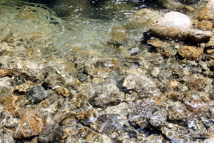
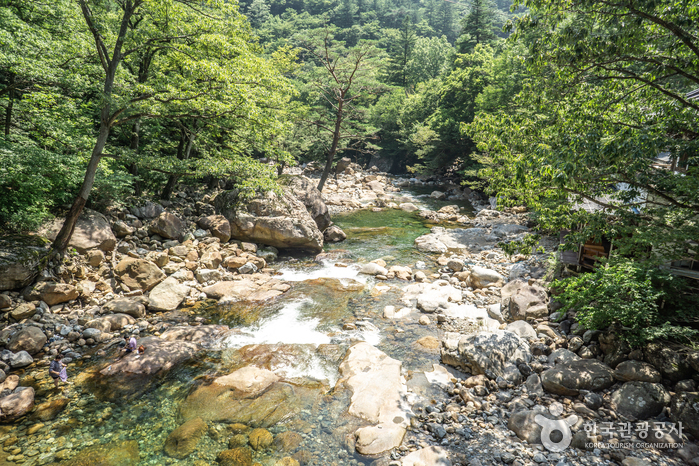
Chilseongyegok Valley is the most beautiful valley in Jirisan Mountain, and is one of the top three valleys in the nation, along with Cheonbuldonggyegok Valley in Seoraksan Mountain and Tamnagyegok Valley in Hallasan Mountain. The 16-kilometer valley stretching from Uitan of Macheon-myeon to Cheonwangbong Peak is characterized by very tough topography but beautiful scenery and is the only remaining primeval forest of Jirisan Mountain. It is also dotted with seven waterfalls and 33 ponds. The hike becomes more difficult as the trail enters the valley. Because the valley has taken many lives, some people call it "The Valley of Death." For that reason, visitors must apply in advance and hike with a guide. The trail in Chilseon Valley is a 9.4-kilometer course from Chuseong Village in Macheon-myeon to Cheonwangbong Peak, which does not follow the natural valley, due to the valley's steep and dangerous features. Starting from Chuseong Village, the trail passes Yongso Pond, Jujiteo Site, Chuseongmang Rock, Seonnyeotang Pond, Ongnyeotang Pond, Biseondam, Chilseonpokpo Falls, Daeryukpokpo Falls, Samcheungpokpo Falls and Mapokpo Falls, all before reaching Cheonwangbong Peak.

Seoamjeongsa Temple (서암정사(함양))
4.1Km 43110 2024-02-21
27-79 Gwangjeom-gil, Macheon-myeon, Hamyang-gun, Gyeongsangnam-do
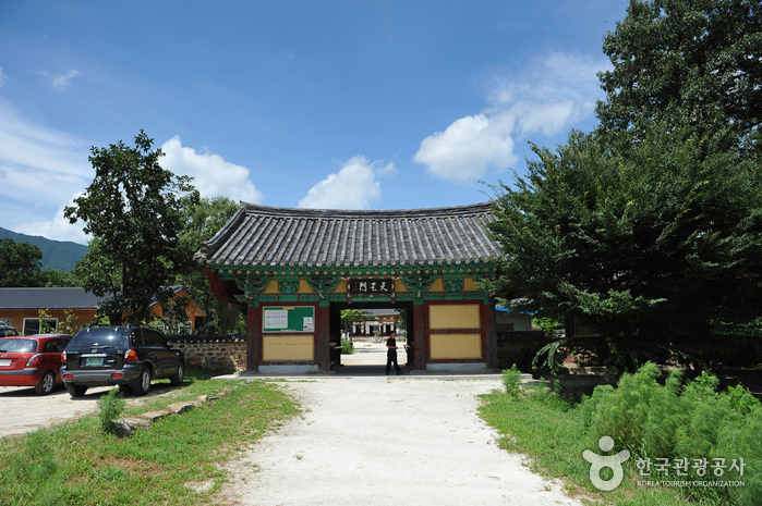
Seoamjeongsa Temple belongs to Byeoksongsa Temple, which is at the entrance of the Chilseongyegok Valley of Jirisan Mountain. Monk Woneung rebuilt Byeoksongsa Temple, which had been damaged during the Korean War in 1950. This hermitage features the Buddha statues Woneung carved into the natural bedrock, a grotto sanctuary with statues of the Pure Land, Daebanggwangmun Gate, and Sajagul Cave.
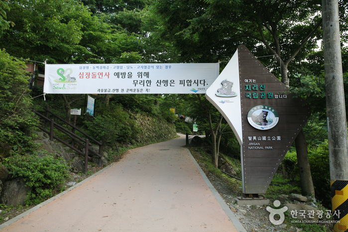
Jirisan National Park (Hamyang Section) (지리산국립공원(함양))
5.4Km 22010 2021-02-05
Baengmudong-ro, Hamyang-gun, Gyeongsangnam-do
+82-55-970-1000
Designated as the first national park in Korea on December 29, 1967, Jirisan National Park stretches out over 483.022 square kilometers, making it the largest national park among all 22 national parks. It covers Korea’s three southernmost provinces; Gyeongsangnam-do, Jeollanam-do, and Jeollabuk-do, one city, four counties, and 15 districts of eup and myeon. The area in Gyeongsangnam-do has Ssanggyesa Temple, Daewonsa Temple, Beopgyesa Temple, Chilbulsa Temple, and Chilsangsa Temple as well as valleys, falls, and other tourism resources. In particular, famous tourist spots in Hamyang area are Chilseongyegok Valley and Hansingyegok Valley.
Jirisan National Park (Sancheong) (지리산국립공원(산청))
6.7Km 74998 2024-02-27
320-2 Jirisan-daero, Sicheon-myeon, Sancheong-gun, Gyeongsangnam-do
+82-55-970-1000
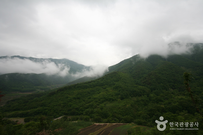
Jirisan National Park is the first national park established in South Korea, featuring peaks like Cheonwangbong Peak (1,915m), Banyabong Peak, and Nogodan Peak, which rank as the next highest after Halla Mountain. It's a popular destination for mountain enthusiasts, offering beautiful natural landscapes such as Naewonsagyegok Valley. The park also provides convenient facilities like Jirisan Recreational Forest, Naewonsa Temple, mountain lodges, campgrounds, and pensions.
Jirisan Cheonwangbong Peak (지리산 천왕봉)
7.0Km 20945 2021-05-14
Jirisan-daero, Sancheong-gun, Gyeongsangnam-do
+82-55-972-7771
Along with Geumgangsan Mountain and Hallasan Mountain, Jirisan Mountain is known to be one of the most sacred mountains in Korea. It was named ‘Jiri’ because it was believed to be a place that turns the innocent into the wise. On December 29, 1967 Jirisan National Park was declared the nation’s first and biggest national park. Its 440.517 square kilometer area covers Hadong, Sancheon and Hamyang in Gyeongsangnam-do; Gurye in Jeollanam-do ; and Namwon in Jeollabuk-do region. The total area is seven times that of Gyeryongsan National Park and 52 times that of all of Yeouido Island in Seoul.
At 1,915.4 meters high, Cheonwangbong Peak is the second highest peak in Jirisan National Park. Countless valleys and waterfalls surround the peak, as well as trails connecting to other peaks within the park.
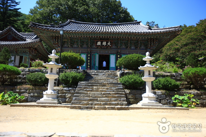
Sancheong Daewonsa Temple (대원사(산청))
7.6Km 18168 2021-08-13
453, Pyeongchonyupyeong-ro, Sancheong-gun, Gyeongsangnam-do
+82-55-972-8068
Located at the eastern foot of Jirisan Mountain, Daewonsa Temple was first built in 548 during the Silla dynasty, but it remained closed for over thousand years until it was renovated and made bigger with the name Daewon. Unfortunately, the entire premises were lost to a big fire during the night of January 12, 1914, and all the halls and pavilions, including Yosachae, totaling 184 rooms in 12 buildings, were rebuilt in 1917. However, they were damaged once again during the Korean War and were abandoned until the war ended where the temple was rejuvenated and made even bigger. Located nearby are Geoyeonjeong and Gunjajeong Halls that are believed to have been the studying venue of scholars.
* Daewonsa Valley
The two-kilometer-long valley that stretches from the parking lot at the entrance to Daewon Temple to the temple itself is surrounded by high hills and curious-looking rocks. The clean water that oozes out through craters between the rocks generates unusual scenery. Associated with Yongso Pond is the legend that a dragon lived in it for hundreds of years before it finally flew away. Somakgol Valley is known to be the place where the last king of Garak Kingdom came to feed his cows and horses.
Daewonsagyegok Valley (대원사계곡)
7.9Km 46018 2021-02-24
Samjang-myeon, Sancheong-gun, Gyeongsangnam-do
+82-55-970-7201
Daewonsagyegok Valley is a place where one can be appreciate nature's musical harmony of stream water, wind brushing against the leaves, and the chirping of birds. The nearly 12-kilometer-long Daewonsagyegok Valley's stream water originates from the highest peak of Jirisan Mountain called Cheonwangbong Peak, and flows through Jungbong and Habong Peaks, as well as Ssukbatjae Pass, Saejae Pass, Wangdeungjae Pass, Bammeorijae Pass, and Ungseokbong Peak. Before reaching the valley, the water joins the currents from Sinbatgol, Jogaegol, and Bambatgol Valleys. The volume of water increases as it passes Saejae and Oegok Village and reaches Yupyeong-ri where Daewonsa Temple is located. The incessant sound of running water fills the silence of the forest as if Buddhist nuns were chanting blessings.
Jirisan Recreational Forest (국립 지리산자연휴양림)
8.9Km 114590 2024-02-23
152 Eumjeong-gil, Macheon-myeon, Hamyang-gun, Gyeongsangnam-do
Jirisan Recreational Forest safeguards the splendid natural beauty of Jirisan Mountain. Positioned 600 to 700 meters above sea level, the region surpassing 700 meters is designated as a national park. The forest features a range of amenities including accommodations, a forest student camp, various trails, a forest park, and a suspension bridge. The significant temperature variation in the area contributes to the breathtaking display of autumn foliage.
Odojae Pass & Jirisan View Park (오도재와 지리산조망공원)
9.1Km 43126 2024-02-08
534 Jirisanganeun-gil, Macheon-myeon, Hamyang-gun, Gyeongsangnam-do
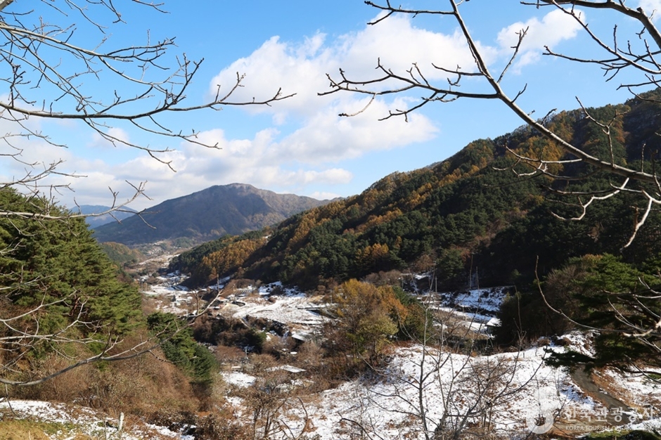
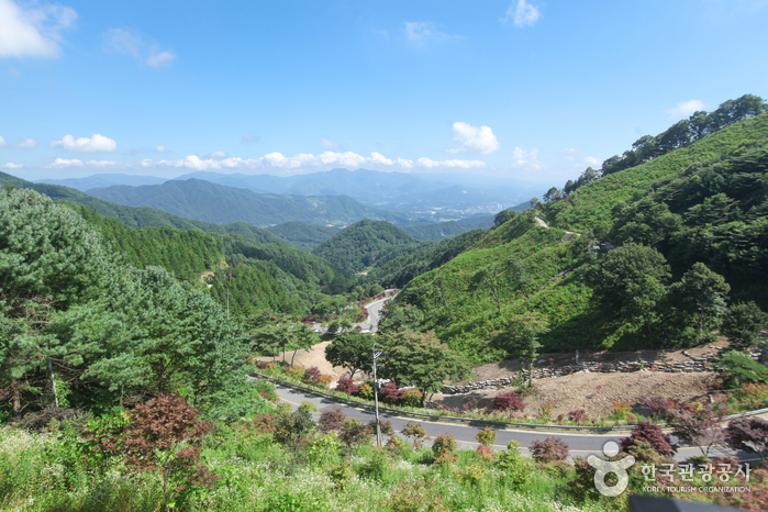
Established as the most direct route from Hamyang to Jirisan in 2004, Odojae Pass has gained recognition not only as a thoroughfare but also for its serpentine path winding through the pass. Positioned just below the summit of Odojae Pass, the expansive Jirisan View Park offers a panoramic view of Jirisan Mountain's main ridge (Nogodan Peak to Cheonwangbong Peak). This park provides a spectacular vista of Jirisan Mountain and a peaceful rest area for travelers navigating Odojae Pass.
Namwon Silsangsa Temple (실상사(남원))
9.8Km 8876 2024-04-07
94-129, Ipseok-gil, Namwon-si, Jeonbuk-do
+82-63-636-3031
Silsangsa Temple was constructed by Monk Jeunggak, as one of nine special temples in the year 828. The temple was established because of the theory of divination, based on topology. The belief held that Korea’s good spirit would be taken away to Japan, bringing bad luck if the temple was not constructed at this particular location. The temple was reconstructed in the 26th year of King Sukjong’s reign (1700) after it was completely destroyed during the Imjin War (1592-1598). However, it was almost burnt down in the 19th year of King Gojong’s reign (1882).
It is presently preserved just as it was during the Unified Silla Kingdom, with its three-story pagoda and its 11 treasures with a total of 17 cultural assets. The entrance of the temple lies in the middle of a rice field and the temple has a pastoral view, surrounded by trees. From the entrance, visitors can cross the half-moon shaped stone bridge to find a remarkable totem pole.
 English
 한국어
한국어 日本語
日本語 中文(简体)
 Deutsch
 Français
 Español
 Русский