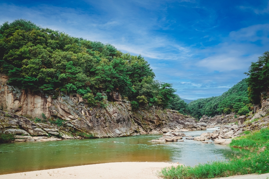
Hantangang River Jusangjeolli-gil (철원 한탄강 주상절리길(잔도))
16.0Km 2025-10-28
San78-2 Guntan-ri, Galmal-eup, Cheorwon-gun, Gangwon-do
This 3.6-km trail in the Hantangang River UNESCO Global Geopark is filled with awe-inspiring cliffs and various size rocks. Walking alongside the cliff, the world unfolds thrillingly beneath your feet. It takes about 1 hour and 30 minutes one way, and on weekends, shuttle buses run between the two entrances, so there's no need to return to the starting point. As you traverse this exhilarating path, you might imagine the "Hangout with Yoo" team walking with their flags as if participating in a team-building exercise.
![Sambuyeonpokpo Falls [UNESCO Global Geopark] (삼부연폭포 (한탄강 유네스코 세계지질공원)](http://tong.visitkorea.or.kr/cms/resource/38/1750438_image2_1.jpg)
Sambuyeonpokpo Falls [UNESCO Global Geopark] (삼부연폭포 (한탄강 유네스코 세계지질공원)
19.2Km 2024-03-20
Sincheorwon-ri, Galmal-eup, Cheorwon-gun, Gangwon-do
Sambuyeonpokpo Falls, among the nine scenic spots in Cheorwon, is a three-tiered waterfall standing at approximately 20 meters high, situated in the granite area of Myeongseongsan Mountain. This natural wonder was formed by water flowing over an extended period subsequent to the exposure of granite intrusion from the Mesozoic Cretaceous period, estimated to be around 110 million years ago. The name "Sambuyeon" originates from the distinctive three bends in the water stream and the lower part of the waterfall's resemblance to a cauldron.
 English
 한국어
한국어 日本語
日本語 中文(简体)
 Deutsch
 Français
 Español
 Русский