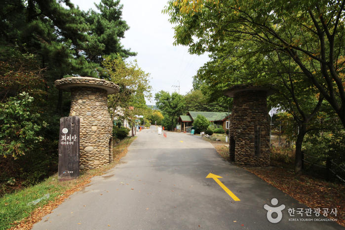
Huirisan Pine Tree Recreational Forest (국립 희리산해송자연휴양림)
17.5Km 42079 2022-07-22
+82-41-953-2230
Surrounded by majestic pine trees, Huirisan Mountain boasts an outstanding landscape; there is a reservoir at the foot of the mountain. Upon climbing to the top of the mountain, visitor can overlook the scenic West Sea. There are also numerous attractions near Huirisan: Chunjangdae Beach, Geumgang River Banks, and Hansan Mosi Town (“Mosi” referring to “Ramie,” the predominant fabric used for traditional Korean clothing)
The top of the mountain (329m in x_height) is called Munsubong (or Munsu Peak). To the northwest of the Huirisan Pine Tree Recreational Forest is Saindae. Legend goes that four generals used to play there. Indeed, there is a cliff (140m in x_height) just below Saindae where they were believed to do chin-ups. Naturally, people call the area Teokgeolijang (Chin-Up Spot). Traces of Munsusa Temple still remain below Munsubong although it was said to have been destroyed by a huge number of bedbugs. 500m from Munsubong to the south, horse riding trails of the four generals are dotted along the ridge; Malttongbawi (Horse Dung Rock), resembling horse droppings, is 500m from the peak to the southeast.
Below Munsubong are four large peaks where the four generals lived and 100 small rocks beneath them that were home to low ranking men commanded by the generals. Because of their unique shapes, those rocks form a scenic sight while hiking in Huirisan.

Bieung Mapaji Trail (비응 마파지길)
17.6Km 0 2024-04-06
1331 Oehang-ro, Gunsan-si, Jeonbuk-do
Bieung Mapaji Trail is a deck walkway along the coast of Biungdo Island. "Mapaji" means a place where the maparam (south wind) blows in Korean, and visitors can enjoy a refreshing walk while feeling the cool breeze from the sea. While strolling along the coastal scenery, visitors come across observation decks. From these decks, they can enjoy panoramic views of Bieung Port and the expansive scenery of the Seohae Sea.
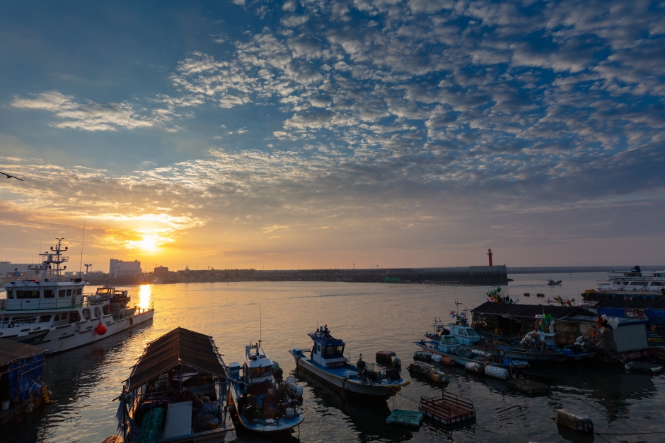
Bieung Port (비응항)
18.4Km 0 2024-04-07
74-11 , Bieungnam-ro, Gunsan-si, Jeonbuk-do
+82-63-454-4000
Bieung Port is the starting point of Saemangeum Embankment which is at the entrance of the Saemangeum tourist area. Bieung Port was once closed due to the excess of soil sedimentation after the construction of Geumgang Estuary seawall. In addition, when the shores were closed off with the Saemangeum Embankment reconstruction project, a new port was in need and thus Bieung Port was repaired and reopened along with two other ports. Bieung Port in particular was constructed as a multi-functioning fisheries port so that it may be incorporated with the nearby attractions in the tourism business.
 English
 한국어
한국어 日本語
日本語 中文(简体)
 Deutsch
 Français
 Español
 Русский